
Browse In:
Shop by Brand: Garmin
Sort by
Items 1-
32
of 640 total
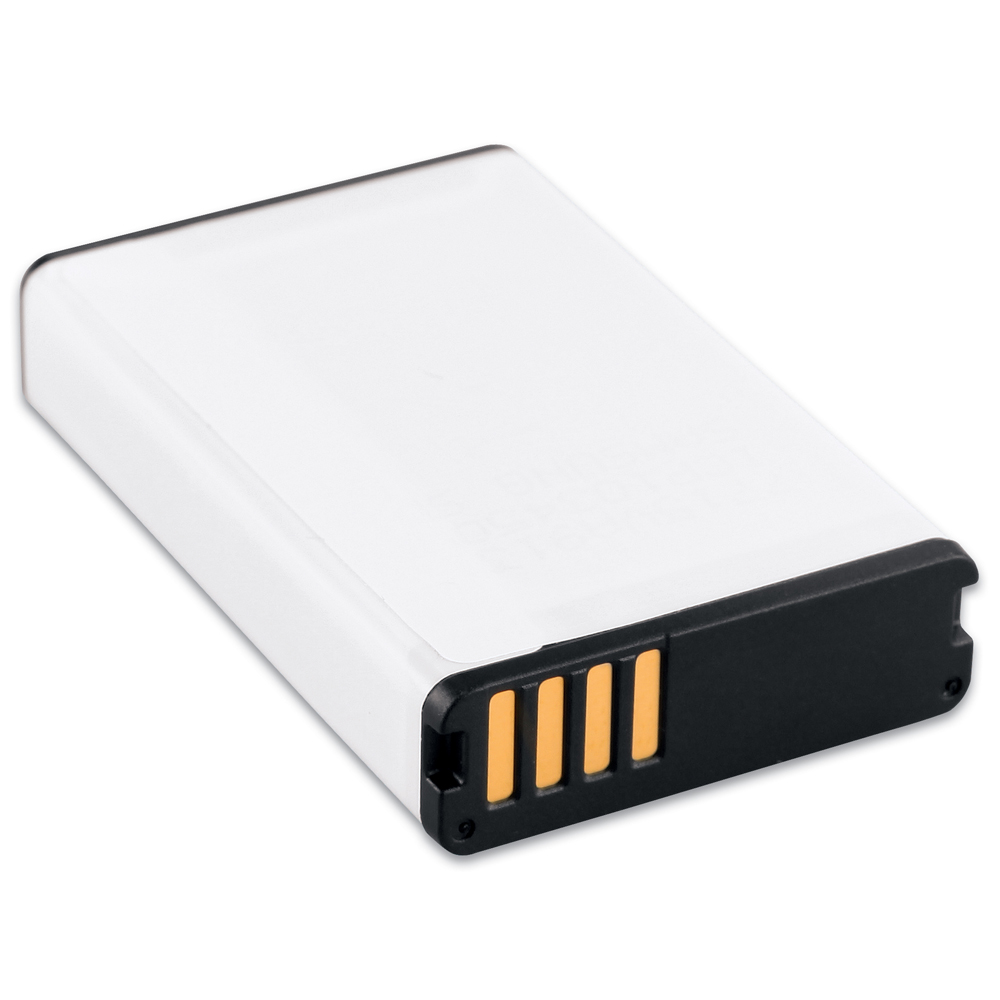
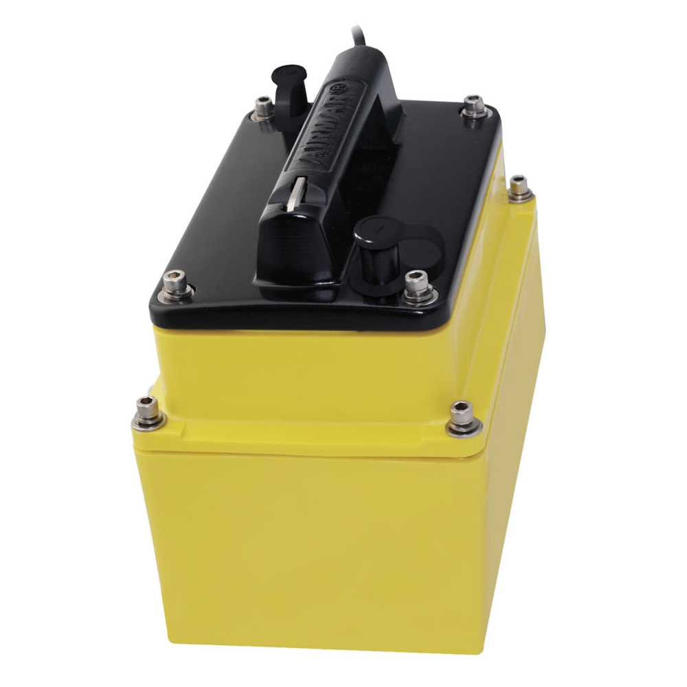
Garmin Li-Ion Battery Pack
Garmin Li-Ion Battery Pack
Online
$29.98for Each
Retail $36.99
Mfr PN: 010-11654-03
Stock: 0
|
Lithium-Ion Battery Pack
For extended outings with your Montana, bring an extra Li-Ion battery pack, or purchase this as a replacement. Compatible Devices:
|
 WARNING: This product can expose you to chemicals which are known to the State of California to cause cancer, birth defects or other reproductive harm. For more information go to
 Online
$29.98for Each
Retail $36.99
Mfr PN: 010-11654-03
Stock: 0
Garmin Lithium-ion Battery Pack f/Rino 6xx / 7xx
Garmin Lithium-ion Battery Pack f/Rino 6xx / 7xx
Online
$106.64for Each
Retail $133.30
Mfr PN: 010-11599-10
Stock: 104
|
Lithium-ion Battery Pack f/Rino® 6xx / 7xx
For extended outings, bring an extra Lithium-ion battery pack for your compatible Rino handheld.
|
Online
$106.64for Each
Retail $133.30
Mfr PN: 010-11599-10
Stock: 104
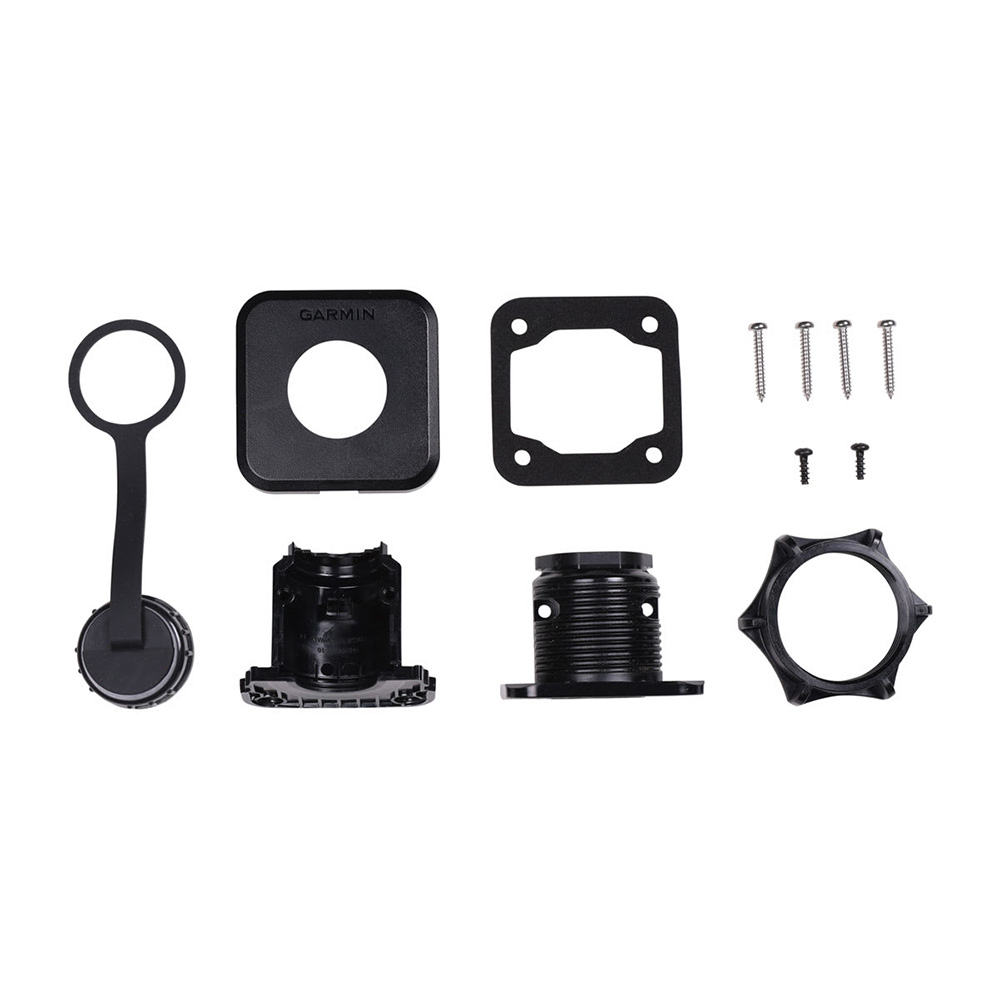
Garmin LiveScope Bulkhead Connector Kit
Garmin LiveScope Bulkhead Connector Kit
Online
$39.97for Each
Retail $39.99
Mfr PN: 010-13350-00
Stock: 0
|
LiveScope™ Bulkhead Connector Kit Flush-mount the LiveScope™ extension cable so users can quickly connect and disconnect the LiveScope™ transducer. The kit includes a snap-on base, cover, weatherproof cap, and all mounting components. Compatible Devices:
|
Online
$39.97for Each
Retail $39.99
Mfr PN: 010-13350-00
Stock: 0
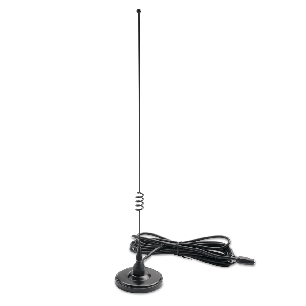
Garmin Long-Range VHF Antenna f/Alpha Astro DC50 Dog Tracking Collar, TB 10 & TT 10
Garmin Long-Range VHF Antenna f/Alpha Astro DC50 Dog Tracking Collar, TB 10 & TT 10
Online
$17.32for Each
Retail $19.99
Mfr PN: 010-11828-11
Stock: 0
|
Long-Range VHF Antenna
Increase your tracking range with this 22-1/2" flexible, long-range antenna. Compatible Devices:
|
Online
$17.32for Each
Retail $19.99
Mfr PN: 010-11828-11
Stock: 0
Garmin M265LH Plastic In-Hull Mount Transducer w/Depth - 12-Pin
Garmin M265LH Plastic In-Hull Mount Transducer w/Depth - 12-Pin
Online
$1387.48for Each
Retail $1398.81
Mfr PN: 010-12380-20
Stock: 0
|
M265LH Plastic In-Hull Mount Transducer w/Depth - 12-Pin
Garmn's best performing 1 kW in-hull, this narrow beam transducer provides crisp image detail. The transducer has a depth of 3,000 feet; an operating frequency of 42 to 65 kHz and 130 to 210 kHz; a beamwidth of 16 to 25 degrees or 6 to 10 degrees; and a 0 to 30 degree deadrise. Transducer kit comes with installation instructions. Follow the instructions carefully to avoid damaging your boat. *Not recommended for cored-hull vessels Compatible Devices:
|
Online
$1387.48for Each
Retail $1398.81
Mfr PN: 010-12380-20
Stock: 0
Garmin Magnetic Mount Antenna f/Astro, Astro 220 & Alpha
Garmin Magnetic Mount Antenna f/Astro, Astro 220 & Alpha
Online
$31.98for Each
Retail $39.00
Mfr PN: 010-10931-00
Stock: 40
|
Magnetic Mount Antenna
This powerful remote antenna magnetically mounts to your vehicle and connects to the Astro® 220 so you can track your dogs with Astro® while driving. Compatible Devices:
|
Online
$31.98for Each
Retail $39.00
Mfr PN: 010-10931-00
Stock: 40
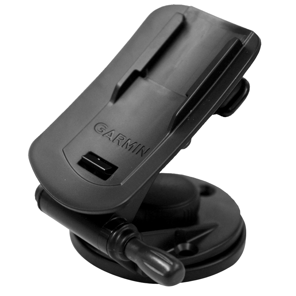
Garmin Marine & Car Mount
Garmin Marine & Car Mount
Online
$21.98for Each
Retail $29.99
Mfr PN: 010-11031-00
Stock: 0
|
This mount attaches to any flat surface and is easily adjusted for optimal viewing.
|
Online
$21.98for Each
Retail $29.99
Mfr PN: 010-11031-00
Stock: 0
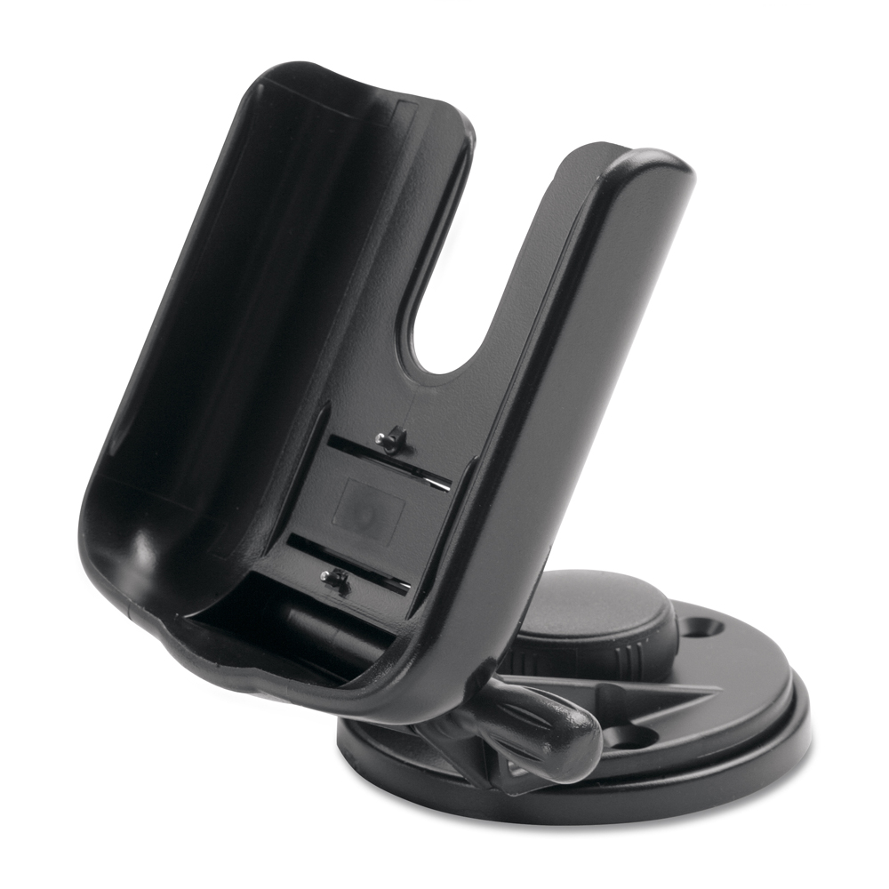
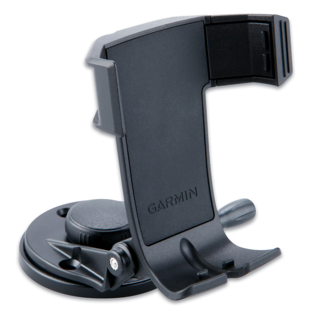
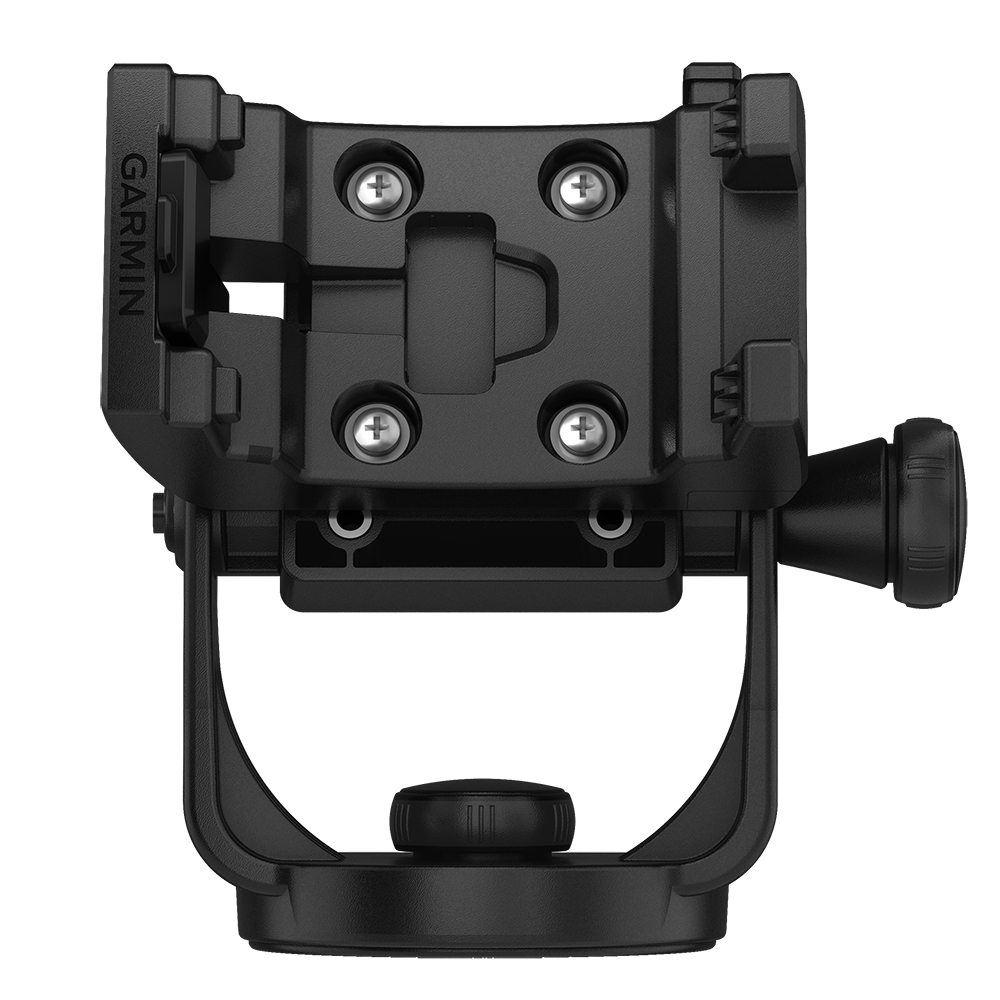
Garmin Marine Mount
Garmin Marine Mount
Online
$32.65for Each
Retail $40.81
Mfr PN: 010-10300-00
Stock: 0
|
Free up your hands to drive the boat, fish, or just enjoy your time on the water. This adjustable marine mount swivels and tilts for optimum viewing and has a locking mechanism to keep unit secure. Accepts optional external power adapter for quick connection to a DC power supply.
Compatible Units:
|
Online
$32.65for Each
Retail $40.81
Mfr PN: 010-10300-00
Stock: 0
Garmin Marine Mount 78 Series
Garmin Marine Mount 78 Series
Online
$29.98for Each
Retail $37.48
Mfr PN: 010-11441-00
Stock: 3
|
Marine Mount For 78 Series
Attach our marine mount to your helm, then swivel or tilt for optimal viewing. An easy locking mechanism keeps your compatible device secure while you're underway, then releases to remove the device.
|
Online
$29.98for Each
Retail $37.48
Mfr PN: 010-11441-00
Stock: 3
Garmin Marine Mount w/Power Cable
Garmin Marine Mount w/Power Cable
Online
$138.65for Each
Mfr PN: 010-12881-02
Stock: 7
|
Marine Mount with Power Cable Take your compatible device from the outdoors to the water with this mount1 and hardware. Kit includes mount, hardware, and cable with bare power, audio, and data wires. 1 To achieve optimal performance, portrait mode is recommended for Montana® 700i and Montana 750i devices. |
Online
$138.65for Each
Mfr PN: 010-12881-02
Stock: 7
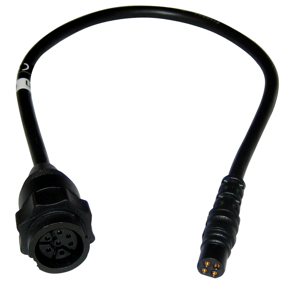
Garmin Marine Network Adapter Cable (Small to Large)
Garmin Marine Network Adapter Cable (Small to Large)
Online
$24.98for Each
Retail $31.23
Mfr PN: 010-12531-01
Stock: 53
|
Marine Network Adapter Cable (Small to Large) Convert your compatible device’s network connector from small to large so it can connect to a compatible Garmin chartplotter.
|
Online
$24.98for Each
Retail $31.23
Mfr PN: 010-12531-01
Stock: 53
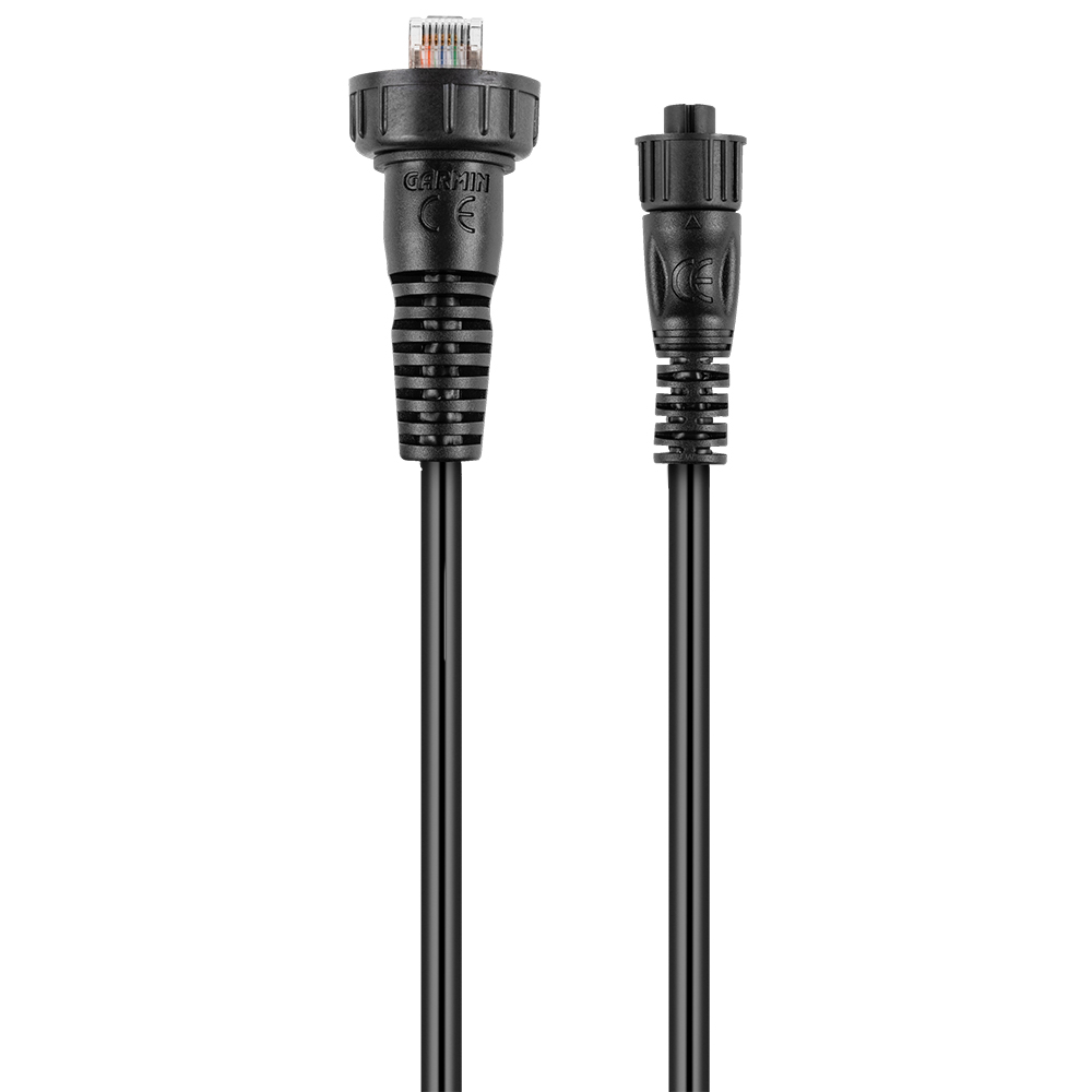
Garmin Marine Network Adapter Cable - Small (Female) to Large
Garmin Marine Network Adapter Cable - Small (Female) to Large
Online
$29.98for Each
Retail $29.99
Mfr PN: 010-12531-10
Stock: 41
|
Marine Network Adapter Cable - Small (Female) to Large Adapt the small network connector to the larger Garmin Marine Network connector with this cable — which is part of the Panoptix™ LiveScope ice fishing kit. |
Online
$29.98for Each
Retail $29.99
Mfr PN: 010-12531-10
Stock: 41
Garmin Marine Network Adapter Cable - Small Female (Right Angle) to Large Female
Garmin Marine Network Adapter Cable - Small Female (Right Angle) to Large Female
Online
$29.98for Each
Retail $29.99
Mfr PN: 010-13094-00
Stock: 9
|
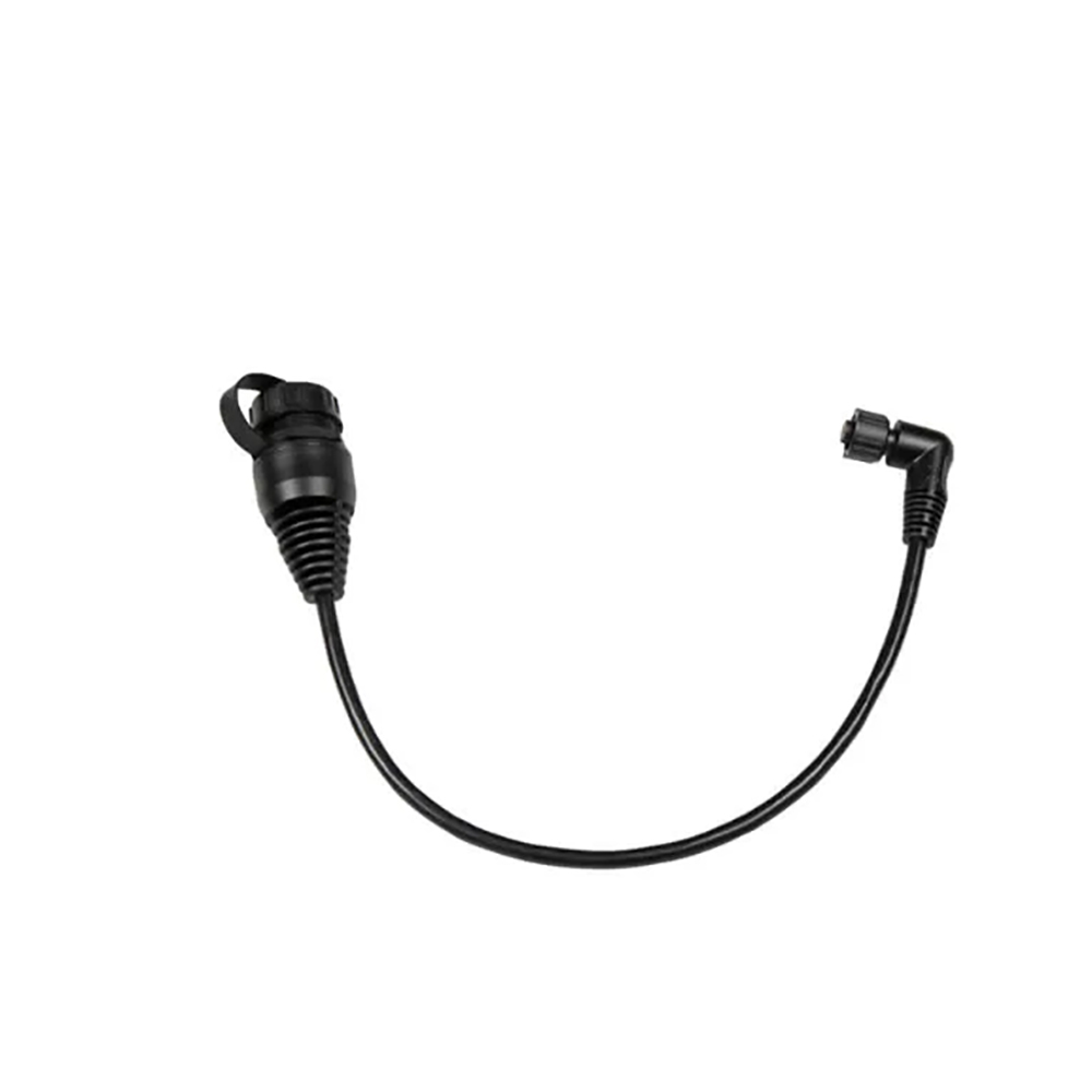
Marine Network Adapter Cable - Small Female (Right Angle) to Large Female Adapt the small network connector on your Garmin device to a large connector of Garmin Marine Network cables. Compatible with:
Technical Specifications:
*Sold as an Individual |
Online
$29.98for Each
Retail $29.99
Mfr PN: 010-13094-00
Stock: 9
Garmin Marine Network Cable Connector RJ45 - 2-Pack
Garmin Marine Network Cable Connector RJ45 - 2-Pack
Online
$13.97for Each
Retail $17.46
Mfr PN: 010-10603-00
Stock: 71
|
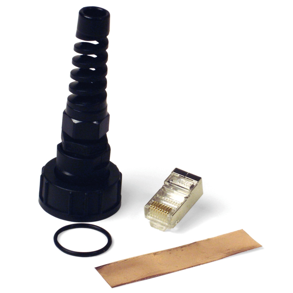
Marine network cable connector RJ45, 2-Pack
|
Online
$13.97for Each
Retail $17.46
Mfr PN: 010-10603-00
Stock: 71
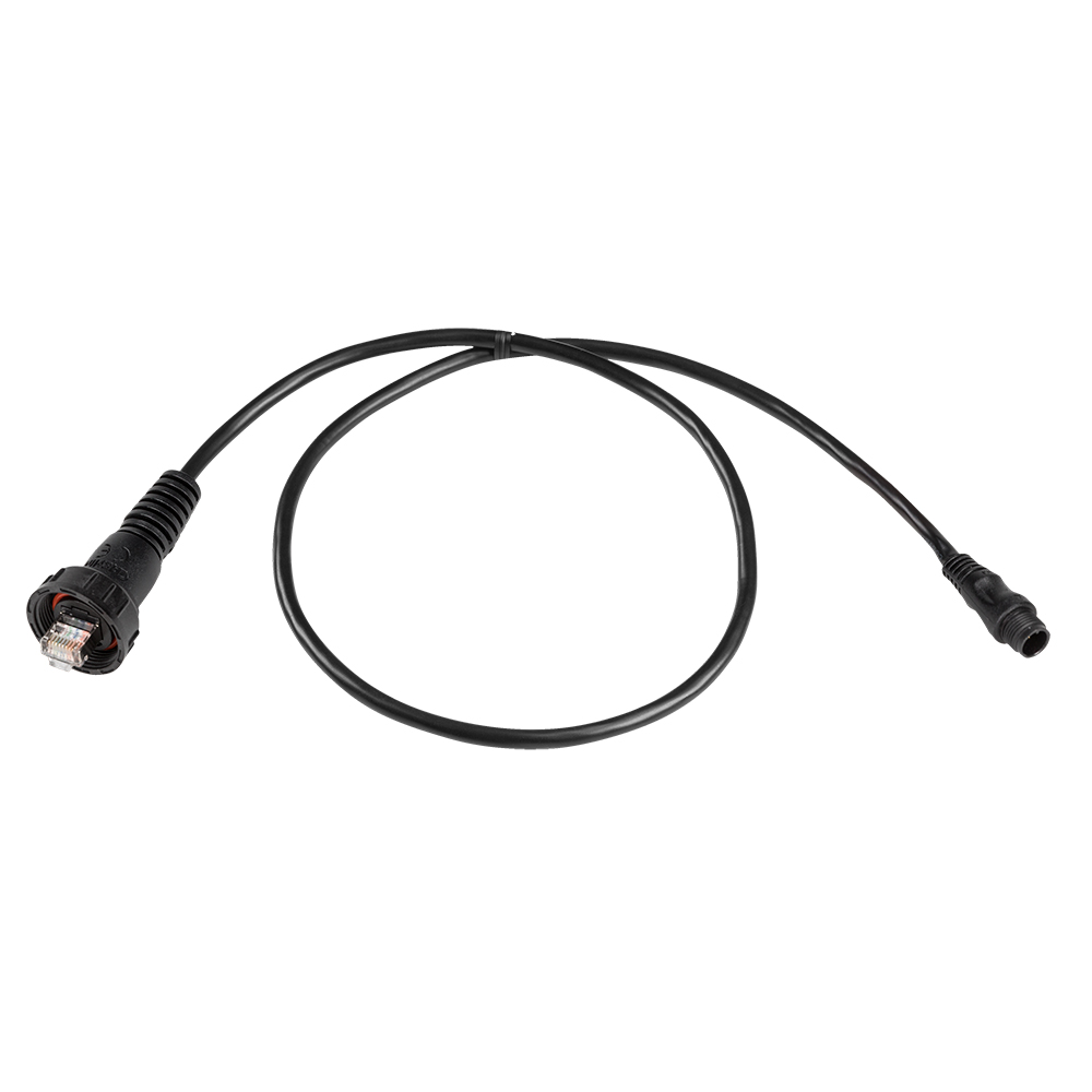
Garmin Marine Network Cables w/ Small Connector - 12m
Garmin Marine Network Cables w/ Small Connector - 12m
Online
$64.98for Each
Retail $81.22
Mfr PN: 010-12528-02
Stock: 9
|
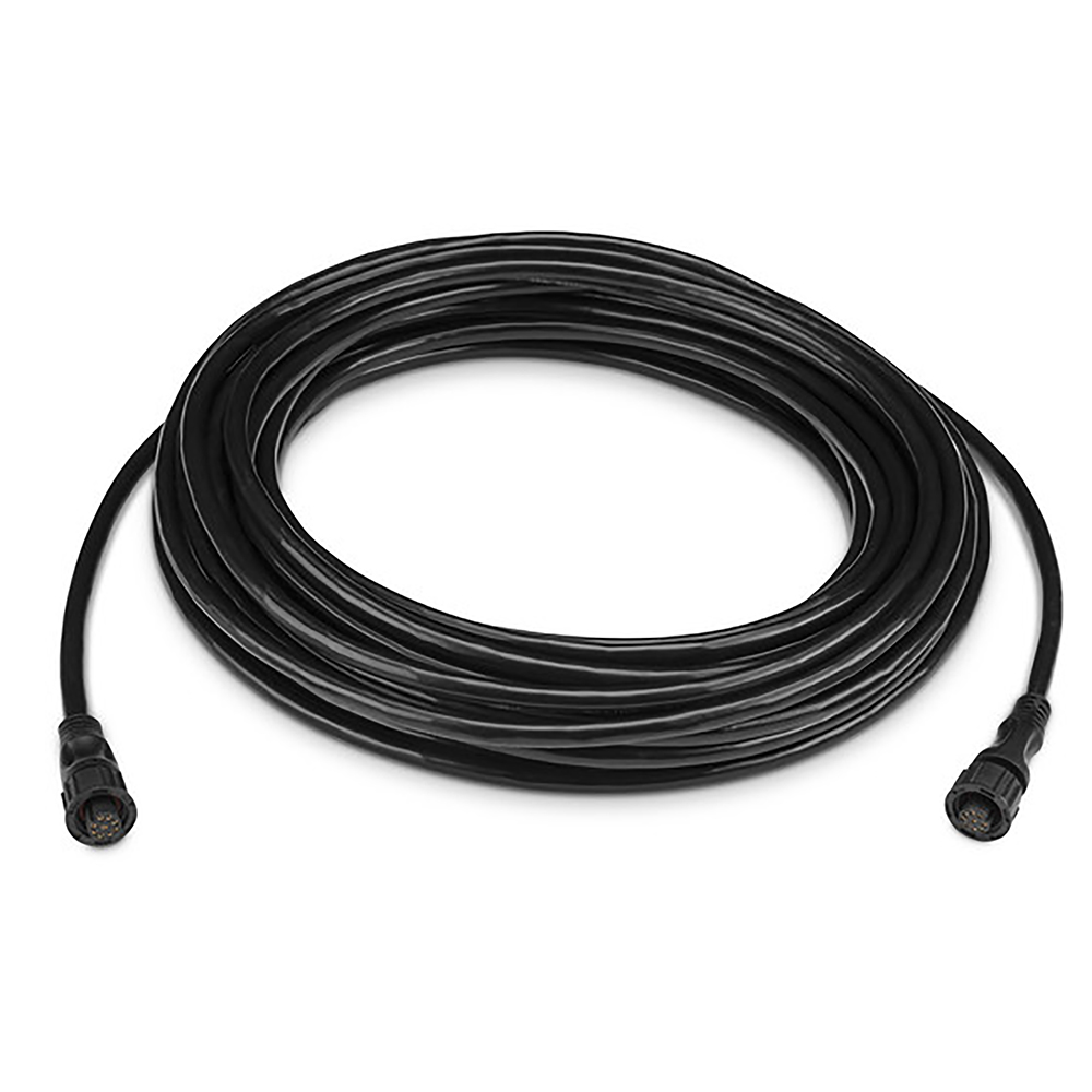
Marine Network Cables w/ Small Connector - 12m Our small-connector marine network cables offer additional cable lengths to help with install.
|
Online
$64.98for Each
Retail $81.22
Mfr PN: 010-12528-02
Stock: 9
Garmin Motorcycle Mount Bracket f/zūmo 350LM
Garmin Motorcycle Mount Bracket f/zūmo 350LM
Online
$21.32for Each
Retail $26.65
Mfr PN: 010-11843-00
Stock: 20
|
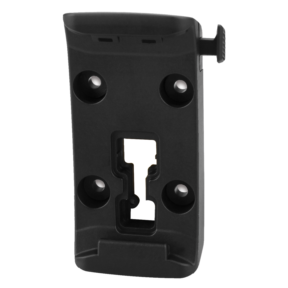
Motorcycle Mount Bracket
Mount your zūmo® 350LM to your motorcycle with this bracket that attaches to the bike's handlebars using a RAM mount (sold separately).
|
Online
$21.32for Each
Retail $26.65
Mfr PN: 010-11843-00
Stock: 20
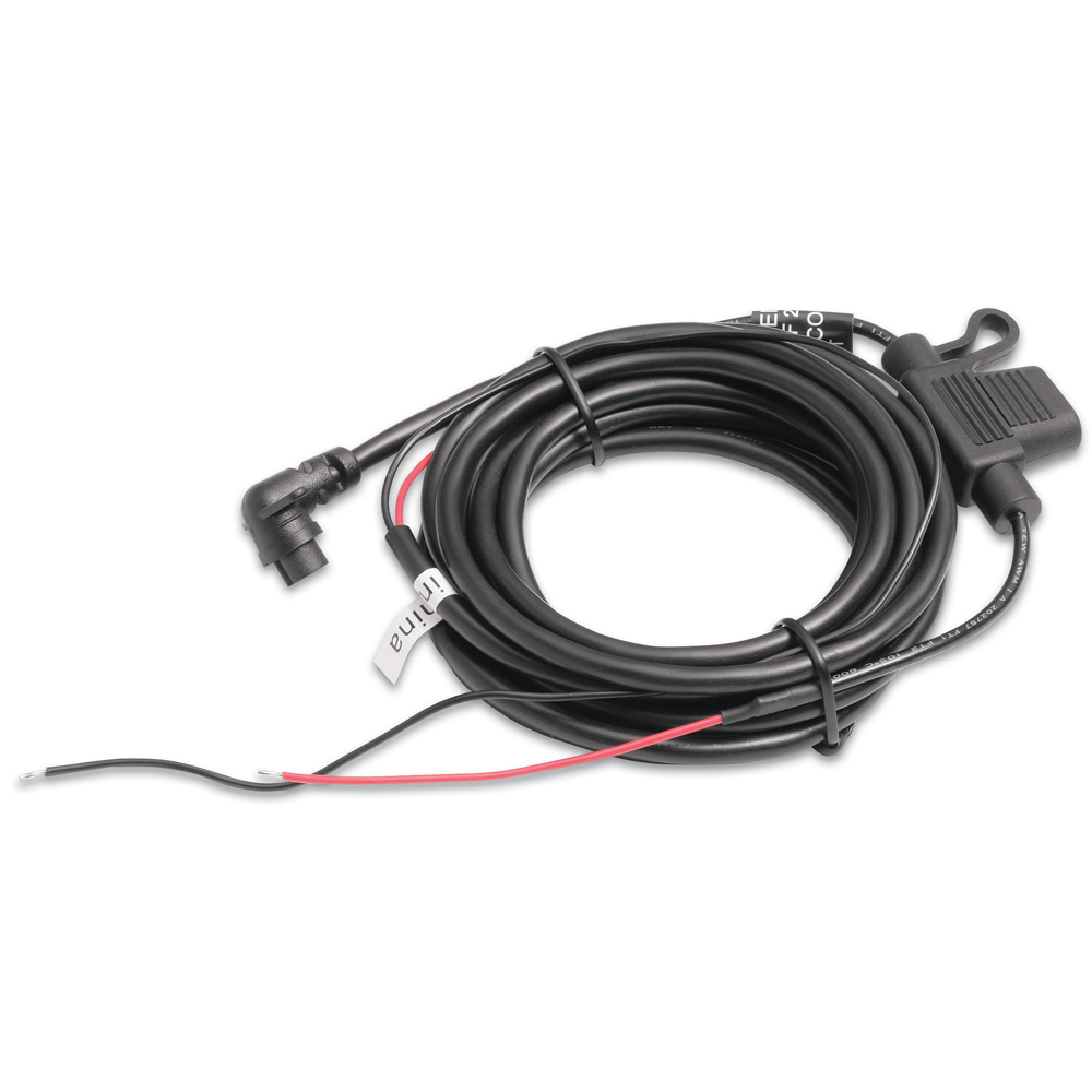
Garmin Motorcycle Power Cable f/zumo
Garmin Motorcycle Power Cable f/zumo
Online
$15.77for Each
Retail $21.50
Mfr PN: 010-10861-00
Stock: 0
|
Charge your zumo while you ride with this replacement motocycle power cable.
|
Online
$15.77for Each
Retail $21.50
Mfr PN: 010-10861-00
Stock: 0
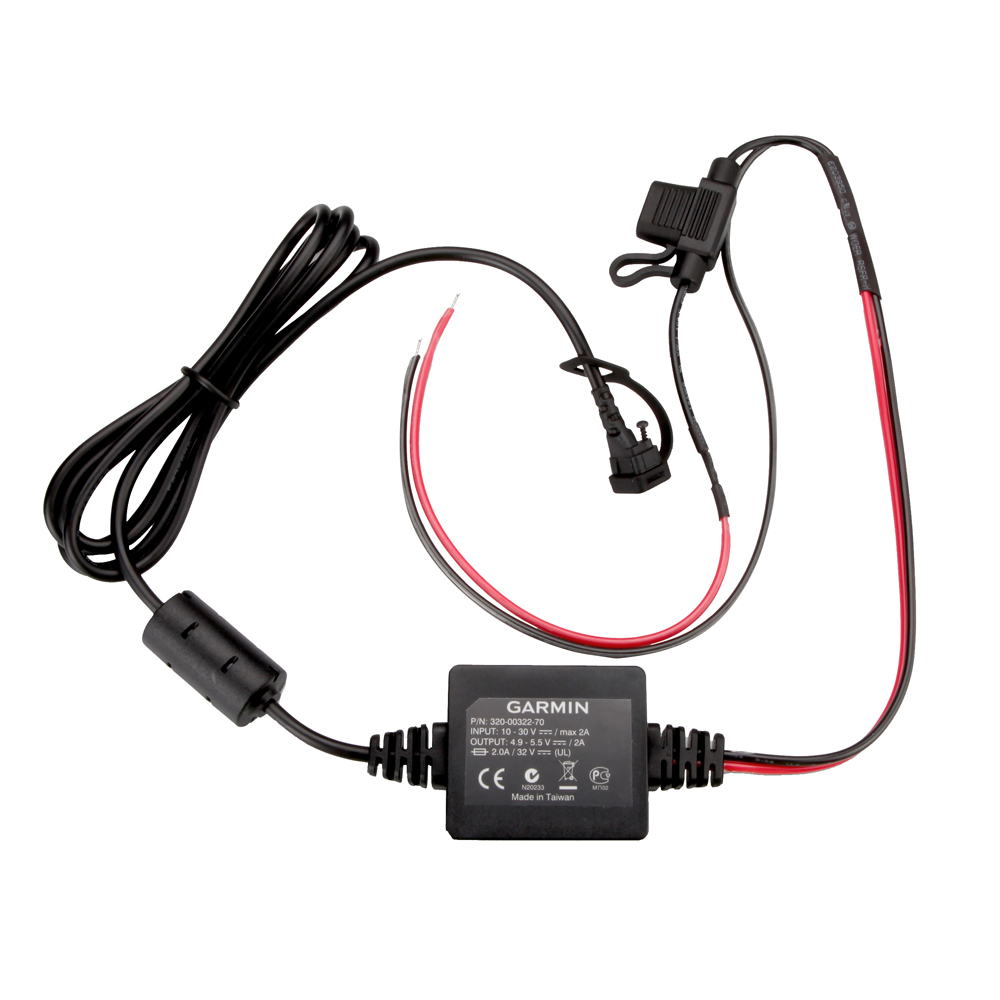
Garmin Motorcycle Power Cord f/zūmo 350LM
Garmin Motorcycle Power Cord f/zūmo 350LM
Online
$53.32for Each
Retail $59.98
Mfr PN: 010-11843-01
Stock: 0
|
Motorcycle Power Cable
Use this power/ground cable in conjunction with a mount bracket (sold separately) to attach your zūmo® 350LM to your motorcycle.
|
Online
$53.32for Each
Retail $59.98
Mfr PN: 010-11843-01
Stock: 0
Garmin MotorGuide Adapter Cable f/4-Pin Units
Garmin MotorGuide Adapter Cable f/4-Pin Units
Online
$39.97for Each
Retail $39.99
Mfr PN: 010-11979-00
Stock: 0
|
MotorGuide Adapter Cables - 4-Pin
Trolling Motor Transducer to 4-Pin Fishfinder Adapter Cable These adapter cables allow you to connect a compatible Garmin unit to a MotorGuide trolling motor transducer. Compatible Garmin units w/8-pin connector: echo™ series, echo dv series Compatible MotorGuide trolling motors:
Wireless Sonar: Xi5:
|
Online
$39.97for Each
Retail $39.99
Mfr PN: 010-11979-00
Stock: 0
Garmin Mount Weather Cover f/z?mo 590
Garmin Mount Weather Cover f/z?mo 590
Online
$11.42for Each
Retail $14.28
Mfr PN: 010-12110-04
Stock: 11
|
Mount Weather Cover for zÅ«mo® 590 Protect the connector pins on your zÅ«mo 590 with this mount weather cover.
|
Online
$11.42for Each
Retail $14.28
Mfr PN: 010-12110-04
Stock: 11
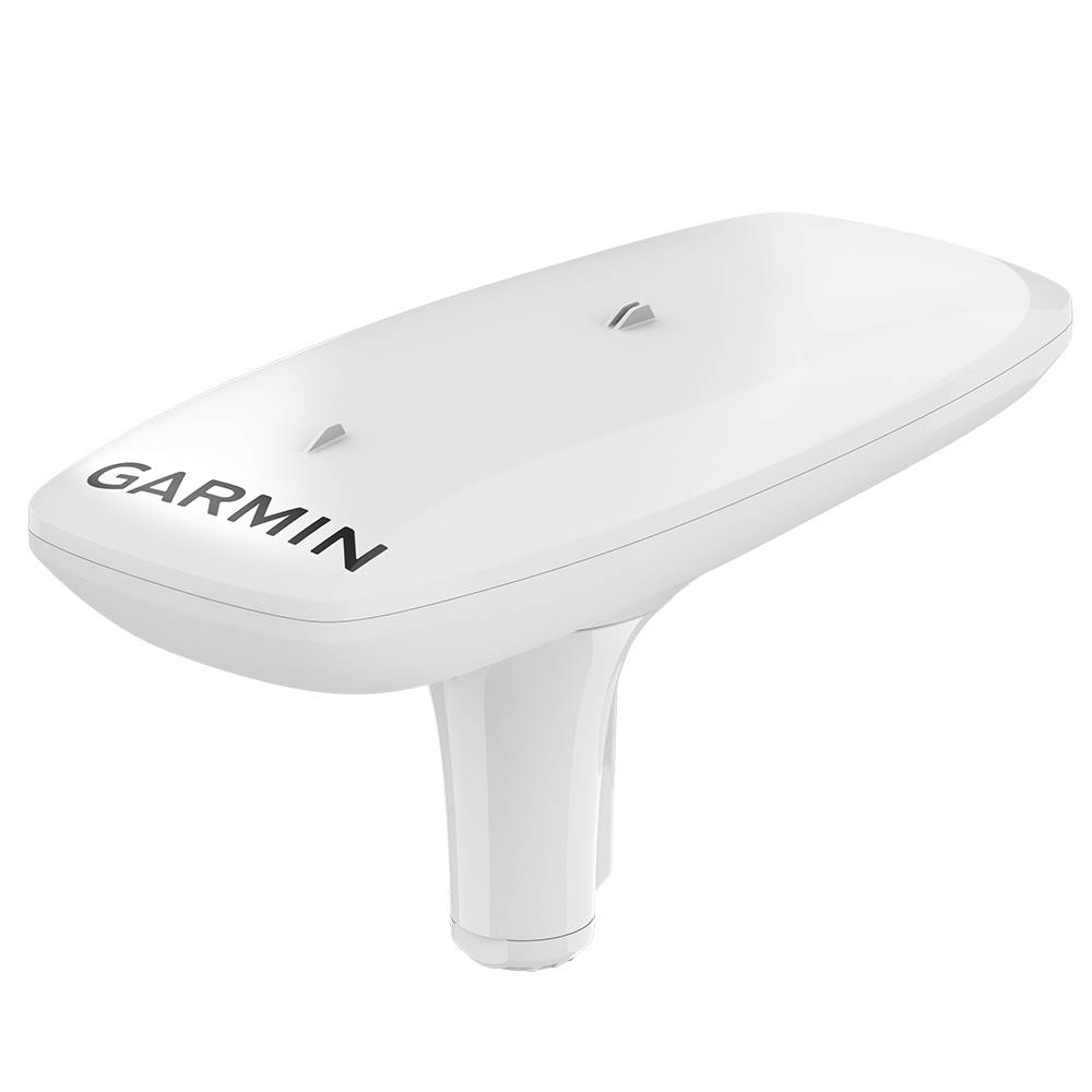
Garmin MSC 10 Marine Satellite Compass
Garmin MSC 10 Marine Satellite Compass
Online
$1099.98for Each
Retail $1099.99
Mfr PN: 010-02407-00
Stock: 4
|
MSC 10 Marine Satellite Compass KNOW EXACTLY WHERE YOU'RE HEADED Get reliable, accurate heading information with the easy-to-install GPS-based MSC 10 marine satellite compass. Features:
MULTI-BAND GNSS AND MULTI-CONSTELLATION The multi-band GNSS (L1 and L5 GPS) and multi-constellation (GPS, Galileo1, GLONASS, and BeiDou1) receiver deliver precise positioning2. BOAT HEAVE AND MORE Get reliable, accurate boat heave, pitch, and roll information — even in rough waters. BUILT-IN ATTITUDE HEADING REFERENCE SYSTEM (AHRS) With a fully integrated attitude and heading reference system for better GPS heading at all speeds, including pitching in rough seas, taking sharp turns, or standing still. ACCURATE HEADING DATA Multiple receivers deliver heading accuracy within 2 degrees. Because it uses satellite signals, you don’t have to worry about magnetic interference. PRIMARY SENSOR ACROSS MULTIPLE SYSTEMS You can use MSC 10 as the primary sensor for autopilots and other onboard systems that need accurate heading information. NMEA 2000® NETWORK COMPATIBLE Get heading, pitch, roll, and heave information delivered straight to your compatible Garmin chartplotter via the NMEA 2000 network. EASY TO INSTALL This compact device is simple to install and easily integrates into your Garmin marine ecosystem. 10 HZ UPDATE RATE Get better, more detailed tracking information, thanks to the 10 Hz position update rate. BACKUP HEADING SENSOR In the extremely rare case that you lose a satellite signal, MSC 10 will seamlessly transition from GPS-based to magnetometer-based heading3. What's In The Box?
1 Supported when available 2 < 1 meter CEP, < 3 meters 95% 3 Magnetometer calibration required for backup magnetic heading support |
Online
$1099.98for Each
Retail $1099.99
Mfr PN: 010-02407-00
Stock: 4
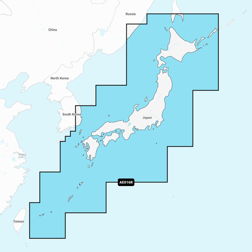
Garmin Navionics Vision+ NVAE016R - Japan - Lakes and Coast - Marine Chart
Garmin Navionics Vision+ NVAE016R - Japan - Lakes and Coast - Marine Chart
Online
$149.98for Each
Retail $199.99
Mfr PN: 010-C1215-00
Stock: 4
|
Navionics Vision+ NVAE016R - Japan - Lakes & Coast - Marine Chart Get the world’s No. 1 choice in the marine mapping with the best, most up-to-date Navionics®+ cartography on your compatible chartplotter. Featuring vibrant colors, a streamlined interface and combined coastal/inland content with a popular Navionics® style color palette, Garmin Navionics+ cartography makes it easy to plot your course. Multiple shading options aid in shallow water navigation and make it easy to highlight a target depth range for the best fishing spots. Fully customizable with various chart layers, overlay combinations and up to 10 color-shaded target depth ranges to scope out the best fishing spots. When you purchase a new Garmin Navionics+ or Garmin Navionics Vision+ cartography product, a one-year subscription is included. Chart Code - NVAE016R Coverage Area: Detailed coverage of coasts of Japan: from Yaeyama Islands, Okinawa to Aniva Bay and Kunashir Island. Coastal coverage of South Korea from Busan to Deoksan-ri. Includes detailed coverage of most major lakes including Inawashiro, Kussharo, Ogawara, Onuma, Shikotsu, Shinji, Towada, and Toyako. Features:
Compatibility:
Technical Specifications:
In the Box:
1Auto Guidance+ is for planning purposes only and does not replace safe navigation operations *Sold as an Individual |
Online
$149.98for Each
Retail $199.99
Mfr PN: 010-C1215-00
Stock: 4
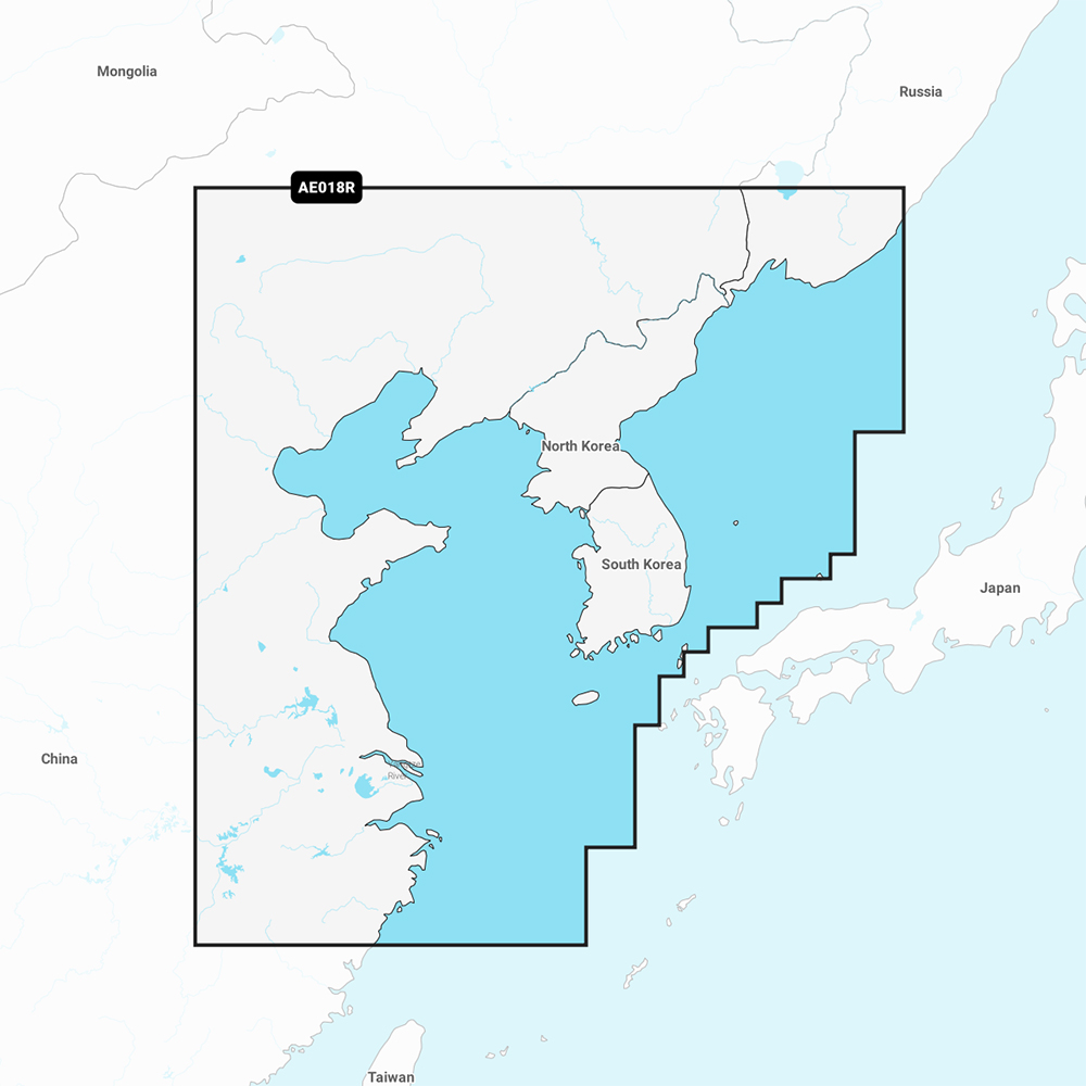
Garmin Navionics Vision+ NVAE018R - Yellow Sea- Marine Chart
Garmin Navionics Vision+ NVAE018R - Yellow Sea- Marine Chart
Online
$149.98for Each
Retail $199.99
Mfr PN: 010-C1216-00
Stock: 4
|
Navionics Vision+ NVAE018R - Yellow Sea- Marine Chart Get the world’s No. 1 choice in the marine mapping with the best, most up-to-date Navionics®+ cartography on your compatible chartplotter. Featuring vibrant colors, a streamlined interface and combined coastal/inland content with a popular Navionics® style color palette, Garmin Navionics+ cartography makes it easy to plot your course. Multiple shading options aid in shallow water navigation and make it easy to highlight a target depth range for the best fishing spots. Fully customizable with various chart layers, overlay combinations and up to 10 color-shaded target depth ranges to scope out the best fishing spots. When you purchase a new Garmin Navionics+ or Garmin Navionics Vision+ cartography product, a one-year subscription is included. Chart Code - NVAE018R Coverage Area: Coastal coverage of the East Asian coast from Vladivostok, RU to Shanghai, CH including the Korean Peninsula. Coverage includes the ports of Busan, South Korea and Dalian, China. Features:
Compatibility:
Technical Specifications:
In the Box:
1Auto Guidance+ is for planning purposes only and does not replace safe navigation operations *Sold as an Individual |
Online
$149.98for Each
Retail $199.99
Mfr PN: 010-C1216-00
Stock: 4
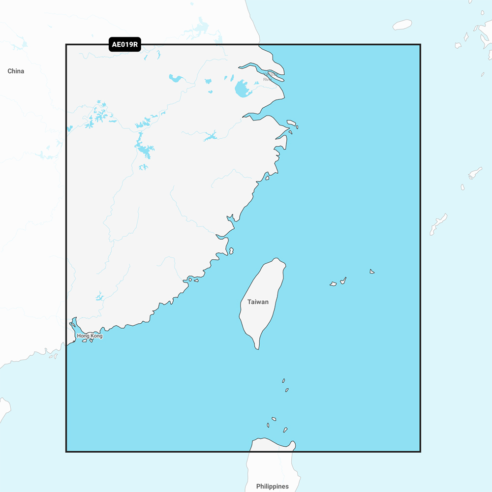
Garmin Navionics Vision+ NVAE019R - Taiwan - Marine Chart
Garmin Navionics Vision+ NVAE019R - Taiwan - Marine Chart
Online
$149.98for Each
Retail $199.99
Mfr PN: 010-C1217-00
Stock: 4
|
Navionics Vision+ NVAE019R - Taiwan - Marine Chart Get the world’s No. 1 choice in the marine mapping with the best, most up-to-date Navionics®+ cartography on your compatible chartplotter. Featuring vibrant colors, a streamlined interface and combined coastal/inland content with a popular Navionics® style color palette, Garmin Navionics+ cartography makes it easy to plot your course. Multiple shading options aid in shallow water navigation and make it easy to highlight a target depth range for the best fishing spots. Fully customizable with various chart layers, overlay combinations and up to 10 color-shaded target depth ranges to scope out the best fishing spots. When you purchase a new Garmin Navionics+ or Garmin Navionics Vision+ cartography product, a one-year subscription is included. Chart Code - NVAE019R Coverage Area: Coastal coverage includes mainland China from Shanghai to Hong Kong and Taiwan. Included in this coverage are detailed charts covering areas such as Macau, Keelong, Kaohsiung, Xiamen, and Guangzhou in China and Kaohsiung, Taichung City and Taipei in Taiwan. Features:
Compatibility:
Technical Specifications:
In the Box:
1Auto Guidance+ is for planning purposes only and does not replace safe navigation operations *Sold as an Individual
|
Online
$149.98for Each
Retail $199.99
Mfr PN: 010-C1217-00
Stock: 4
Garmin Navionics Vision+ NVAE020R - South China & Andaman Seas - Marine Chart
Garmin Navionics Vision+ NVAE020R - South China & Andaman Seas - Marine Chart
Online
$149.98for Each
Retail $199.99
Mfr PN: 010-C1218-00
Stock: 4
|
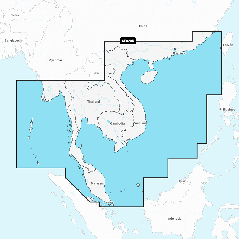
Navionics Vision+ NVAE020R - South China & Andaman Seas - Marine Chart Get the world’s No. 1 choice in the marine mapping with the best, most up-to-date Navionics®+ cartography on your compatible chartplotter. Featuring vibrant colors, a streamlined interface and combined coastal/inland content with a popular Navionics® style color palette, Garmin Navionics+ cartography makes it easy to plot your course. Multiple shading options aid in shallow water navigation and make it easy to highlight a target depth range for the best fishing spots. Fully customizable with various chart layers, overlay combinations and up to 10 color-shaded target depth ranges to scope out the best fishing spots. When you purchase a new Garmin Navionics+ or Garmin Navionics Vision+ cartography product, a one-year subscription is included. Chart Code - NVAE020R Coverage Area: Coastal coverage of the East Asian coast from Xiamen, China to Thailand including the coast of Vietnam, Cambodia, the Malay Peninsula, Hainan Island and the Andaman and Nicobar Islands. Included are detailed charts of such areas as Hong Kong and Macau; Phuket, Thailand; Singapore; Ho Chi Minh City, Vietnam and Guangzhou and Xiamen, China. Features:
Compatibility:
Technical Specifications:
In the Box:
1Auto Guidance+ is for planning purposes only and does not replace safe navigation operations *Sold as an Individual
|
Online
$149.98for Each
Retail $199.99
Mfr PN: 010-C1218-00
Stock: 4
Garmin Navionics Vision+ NVAE021R - Philippines - Marine Chart
Garmin Navionics Vision+ NVAE021R - Philippines - Marine Chart
Online
$149.98for Each
Retail $199.99
Mfr PN: 010-C1219-00
Stock: 4
|
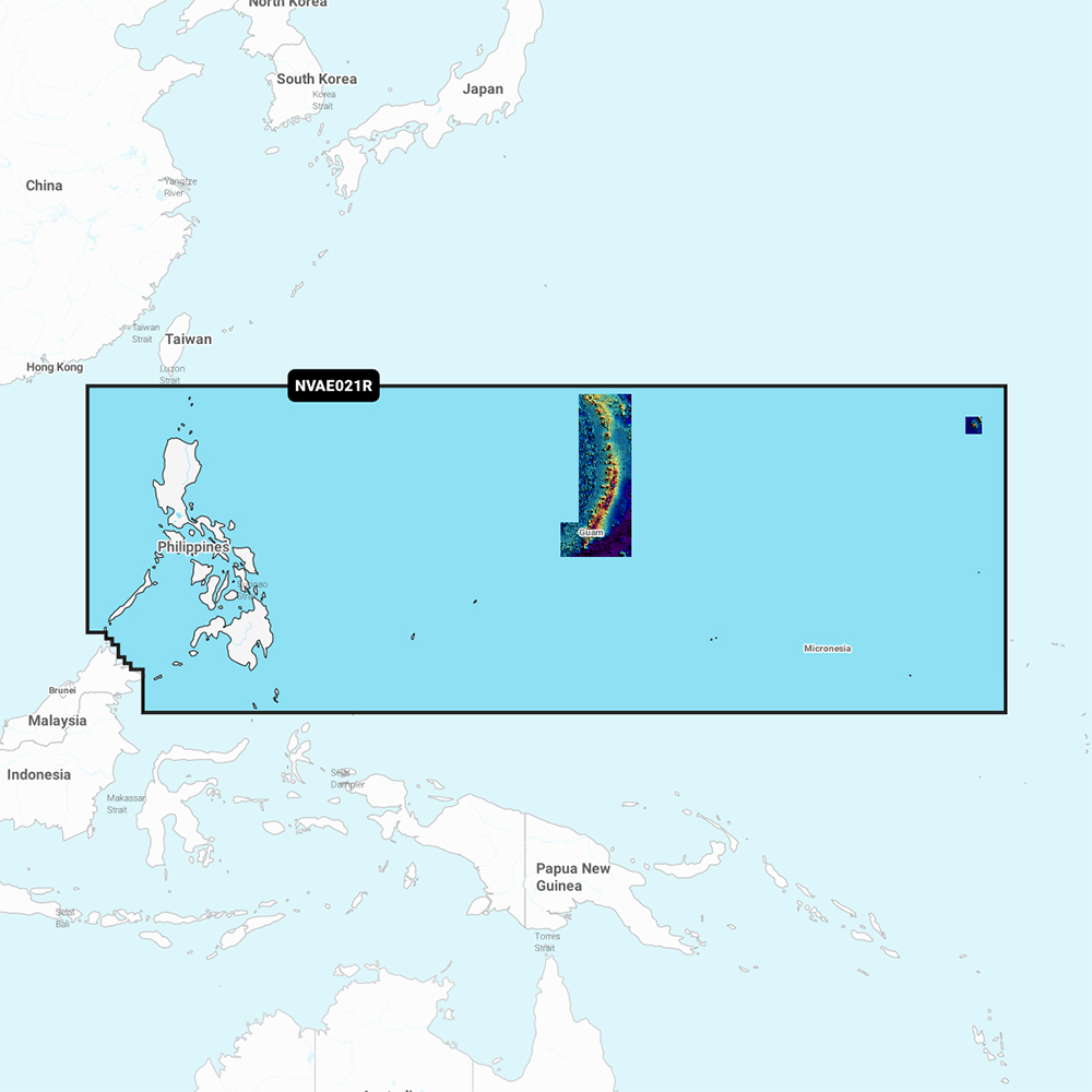
Navionics Vision+ NVAE021R - Philippines - Marine Chart Get the world’s No. 1 choice in the marine mapping with the best, most up-to-date Navionics®+ cartography on your compatible chartplotter. Featuring vibrant colors, a streamlined interface and combined coastal/inland content with a popular Navionics® style color palette, Garmin Navionics+ cartography makes it easy to plot your course. Multiple shading options aid in shallow water navigation and make it easy to highlight a target depth range for the best fishing spots. Fully customizable with various chart layers, overlay combinations and up to 10 color-shaded target depth ranges to scope out the best fishing spots. When you purchase a new Garmin Navionics+ or Garmin Navionics Vision+ cartography product, a one-year subscription is included. Chart Code - NVAE021R Coverage Area: Coastal coverage of the Philippine Islands and islands of Micronesia including the Marianas, Palau, Guam, Saipan and Wake Island. Features:
Compatibility:
Technical Specifications:
In the Box:
1Auto Guidance+ is for planning purposes only and does not replace safe navigation operations *Sold as an Individual |
Online
$149.98for Each
Retail $199.99
Mfr PN: 010-C1219-00
Stock: 4
Garmin Navionics Vision+ NVAE022R - Sumatra - Marine Chart
Garmin Navionics Vision+ NVAE022R - Sumatra - Marine Chart
Online
$149.98for Each
Retail $199.99
Mfr PN: 010-C1220-00
Stock: 4
|
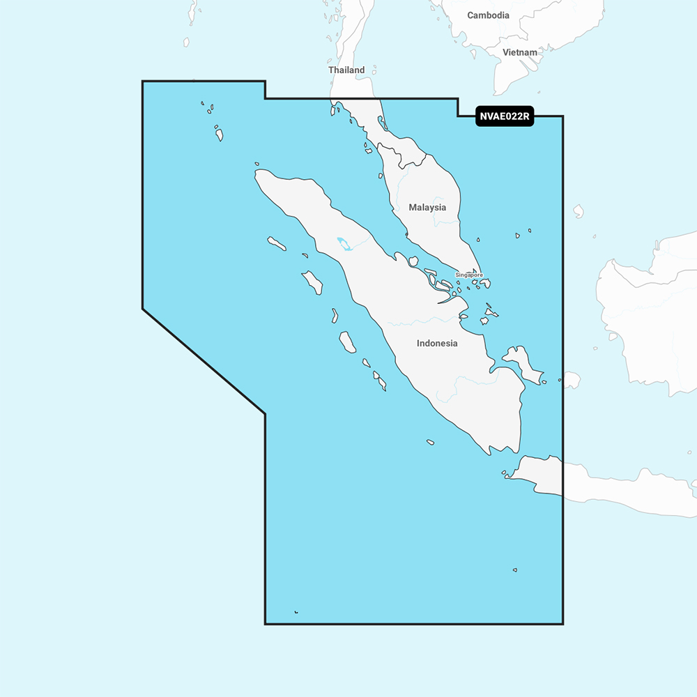
Navionics Vision+ NVAE022R - Sumatra - Marine Chart Get the world’s No. 1 choice in the marine mapping with the best, most up-to-date Navionics®+ cartography on your compatible chartplotter. Featuring vibrant colors, a streamlined interface and combined coastal/inland content with a popular Navionics® style color palette, Garmin Navionics+ cartography makes it easy to plot your course. Multiple shading options aid in shallow water navigation and make it easy to highlight a target depth range for the best fishing spots. Fully customizable with various chart layers, overlay combinations and up to 10 color-shaded target depth ranges to scope out the best fishing spots. When you purchase a new Garmin Navionics+ or Garmin Navionics Vision+ cartography product, a one-year subscription is included. Chart Code - NVAE022R Coverage Area: Coastal coverage of the Malay Peninsula from Phuket, Thailand to Singapore and portions of Indonesia including Java and the entire island of Sumatra. Coverage includes Christmas Island, the Cocos Islands and ports such as Jakarta, Indonesia and Malacca and Kuantan, Malaysia. Features:
Compatibility:
Technical Specifications:
In the Box:
1Auto Guidance+ is for planning purposes only and does not replace safe navigation operations *Sold as an Individual |
Online
$149.98for Each
Retail $199.99
Mfr PN: 010-C1220-00
Stock: 4
Garmin Navionics Vision+ NVAE023R - Java & Borneo - Marine Chart
Garmin Navionics Vision+ NVAE023R - Java & Borneo - Marine Chart
Online
$149.98for Each
Retail $199.99
Mfr PN: 010-C1221-00
Stock: 4
|
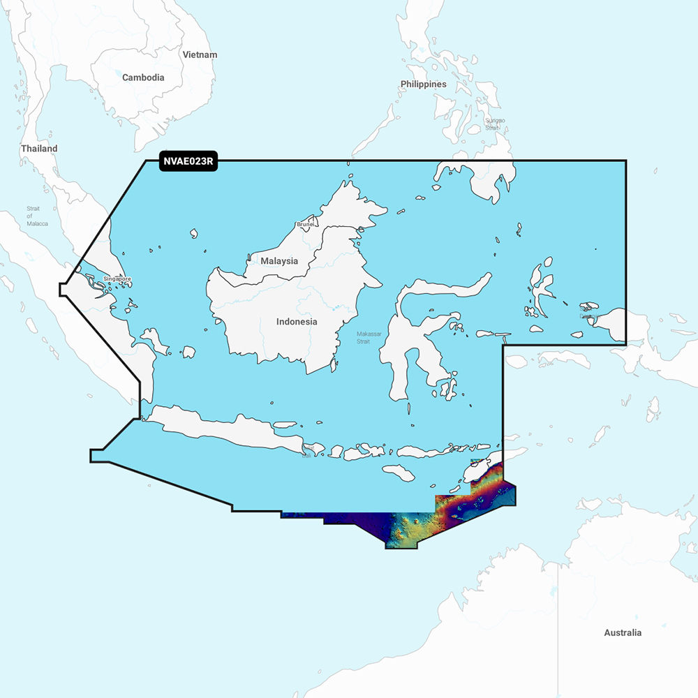
Navionics Vision+ NVAE023R - Java and Borneo - Marine Chart Get the world’s No. 1 choice in the marine mapping with the best, most up-to-date Navionics®+ cartography on your compatible chartplotter. Featuring vibrant colors, a streamlined interface and combined coastal/inland content with a popular Navionics® style color palette, Garmin Navionics+ cartography makes it easy to plot your course. Multiple shading options aid in shallow water navigation and make it easy to highlight a target depth range for the best fishing spots. Fully customizable with various chart layers, overlay combinations and up to 10 color-shaded target depth ranges to scope out the best fishing spots. When you purchase a new Garmin Navionics+ or Garmin Navionics Vision+ cartography product, a one-year subscription is included. Chart Code - NVAE023R Coverage Area: Coastal coverage of the central Indonesian islands and portions of Malaysia and the Philippines. Coverage includes Java, Borneo, Sulawesi and islands west of Timor, Brunei and the ports of Singapore, Jakarta and Davao City. Features:
Compatibility:
Technical Specifications:
In the Box:
1Auto Guidance+ is for planning purposes only and does not replace safe navigation operations *Sold as an Individual
|
Online
$149.98for Each
Retail $199.99
Mfr PN: 010-C1221-00
Stock: 4
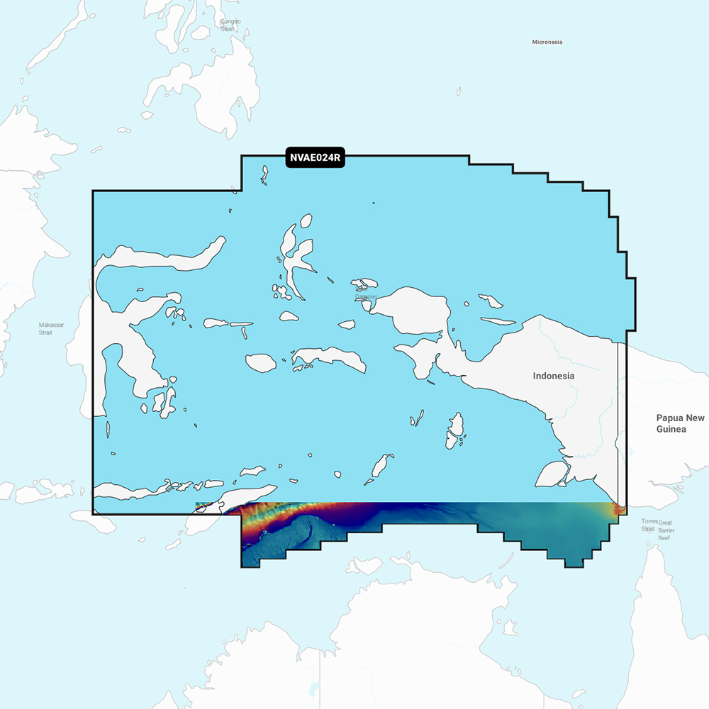
Garmin Navionics Vision+ NVAE024R - Central West Papua & East Sulawesi - Marine Chart
Garmin Navionics Vision+ NVAE024R - Central West Papua & East Sulawesi - Marine Chart
Online
$149.98for Each
Retail $199.99
Mfr PN: 010-C1222-00
Stock: 4
|
Navionics Vision+ NVAE024R - Central West Papua & East Sulawesi - Marine Chart Get the world’s No. 1 choice in the marine mapping with the best, most up-to-date Navionics®+ cartography on your compatible chartplotter. Featuring vibrant colors, a streamlined interface and combined coastal/inland content with a popular Navionics® style color palette, Garmin Navionics+ cartography makes it easy to plot your course. Multiple shading options aid in shallow water navigation and make it easy to highlight a target depth range for the best fishing spots. Fully customizable with various chart layers, overlay combinations and up to 10 color-shaded target depth ranges to scope out the best fishing spots. When you purchase a new Garmin Navionics+ or Garmin Navionics Vision+ cartography product, a one-year subscription is included. Chart Code - NVAE024R Coverage Area: Coastal coverage of Indonesia southeast and east of Sulawesi including East Timor and the ports of Surong, Manokwari, Manado, Makassar and Kendari. Features:
Compatibility:
Technical Specifications:
In the Box:
1Auto Guidance+ is for planning purposes only and does not replace safe navigation operations *Sold as an Individual
|
Online
$149.98for Each
Retail $199.99
Mfr PN: 010-C1222-00
Stock: 4
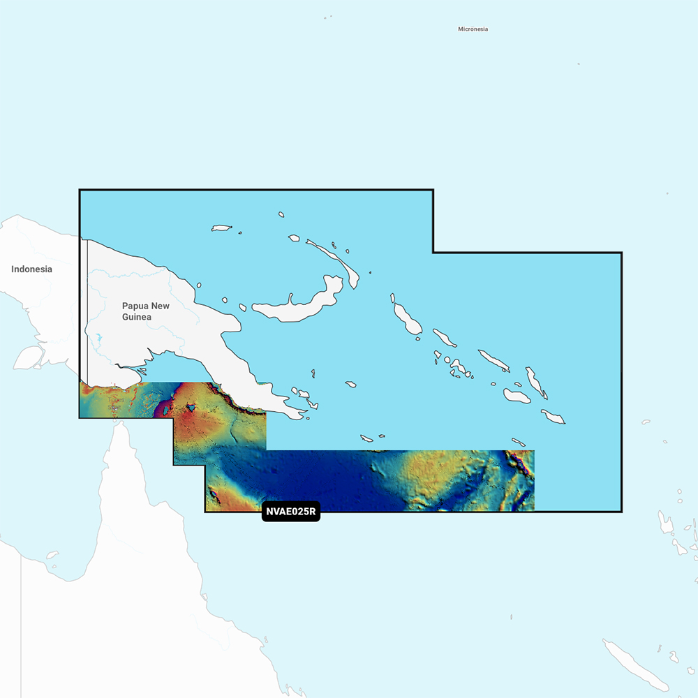
Garmin Navionics Vision+ NVAE025R - Papua New Guinea & Solomon Islands - Marine Chart
Garmin Navionics Vision+ NVAE025R - Papua New Guinea & Solomon Islands - Marine Chart
Online
$149.98for Each
Retail $199.99
Mfr PN: 010-C1223-00
Stock: 4
|
Navionics Vision+ NVAE025R - Papua New Guinea & Solomon Islands - Marine Chart Get the world’s No. 1 choice in the marine mapping with the best, most up-to-date Navionics®+ cartography on your compatible chartplotter. Featuring vibrant colors, a streamlined interface and combined coastal/inland content with a popular Navionics® style color palette, Garmin Navionics+ cartography makes it easy to plot your course. Multiple shading options aid in shallow water navigation and make it easy to highlight a target depth range for the best fishing spots. Fully customizable with various chart layers, overlay combinations and up to 10 color-shaded target depth ranges to scope out the best fishing spots. When you purchase a new Garmin Navionics+ or Garmin Navionics Vision+ cartography product, a one-year subscription is included. Chart Code - NVAE025R Coverage Area: Coastal coverage of Papua New Guinea and the Solomon Islands. Ports include Lae, Rabaul and Port Moresby, Papua New Guinea and Honaira, Solomon Islands. Features:
Compatibility:
Technical Specifications:
In the Box:
1Auto Guidance+ is for planning purposes only and does not replace safe navigation operations *Sold as an Individual
|
Online
$149.98for Each
Retail $199.99
Mfr PN: 010-C1223-00
Stock: 4
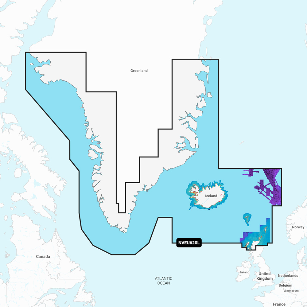
Garmin Navionics Vision+ NVEU620L Greenland & Iceland
Garmin Navionics Vision+ NVEU620L Greenland & Iceland
Online
$249.98for Each
Retail $349.99
Mfr PN: 010-C1270-00
Stock: 6
|
Navionics Vision+™ NVEU620L Greenland & Iceland Get the world’s No. 1 choice in marine mapping with the best, most up-to-date Navionics®+ cartography on your compatible chartplotter. Featuring vibrant colors, a streamlined interface, and combined coastal/inland content with a popular Navionics® style color palette, Garmin Navionics+ cartography makes it easy to plot your course. Multiple shading options aid in shallow-water navigation and make it easy to highlight a target depth range for the best fishing spots. Fully customizable with various chart layers, overlay combinations, and up to 10 color-shaded target depth ranges, users can scope out the best fishing spots. When you purchase a new Garmin Navionics+ or Garmin Navionics Vision+ cartography product, a one-year subscription is included. Chart Code - NVEU620L Coverage Area: Detailed coverage of Greenland, Iceland, the Faeroe Islands, the Shetland Islands, the Orkney Islands, and the northern tip of Britain. Coverage includes Godhavn (Qeqertarsuaq) and Godthab (Nuuk), Greenland; Reykjavik and Akureyri, Iceland; Torshavn, Lerwick, Stromness, Kirkwall, and Thurso, United Kingdom. Features:
Compatibility:
Technical Specifications:
In the Box:
1Auto Guidance+ is for planning purposes only and does not replace safe navigation operations 2Raster cartography cannot be viewed on echoMAP™ CHIRP and ECHOMAP™ Plus combos but can be viewed on mobile devices via the ActiveCaptain mobile app *Sold as an Individual |
Online
$249.98for Each
Retail $349.99
Mfr PN: 010-C1270-00
Stock: 6
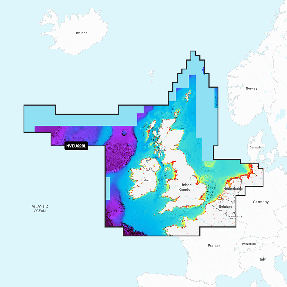
Garmin Navionics Vision+ NVEU628L U.K., Ireland & Holland
Garmin Navionics Vision+ NVEU628L U.K., Ireland & Holland
Online
$249.98for Each
Retail $349.99
Mfr PN: 010-C1271-00
Stock: 6
|
Navionics Vision+™ NVEU628L U.K., Ireland & Holland Get the world’s No. 1 choice in marine mapping with the best, most up-to-date Navionics®+ cartography on your compatible chartplotter. Featuring vibrant colors, a streamlined interface, and combined coastal/inland content with a popular Navionics® style color palette, Garmin Navionics+ cartography makes it easy to plot your course. Multiple shading options aid in shallow-water navigation and make it easy to highlight a target depth range for the best fishing spots. Fully customizable with various chart layers, overlay combinations, and up to 10 color-shaded target depth ranges, users can scope out the best fishing spots. When you purchase a new Garmin Navionics+ or Garmin Navionics Vision+ cartography product, a one-year subscription is included. Chart Code - NVEU628L Coverage Area: Detailed coverage of the UK, Ireland, the North Sea, and the English Channel coasts. Coverage includes the Shetland Islands, Orkney Islands, Isle of Man, Isle of Wight, the Isles of Scilly, the Channel Islands, the Thames River, the IJsselmeer, the Waddenzee, and the Kiel Canal. Ports include London, Liverpool, Southampton, Edinburgh, and Belfast, UK; Dublin and Cork, Ireland; Brest, Le Havre, Calais, and Dunkirk, France; Antwerp, Belgium; Amsterdam and Rotterdam, The Netherlands; and Bremerhaven, Hamburg, and Kiel, Germany. Features:
Compatibility:
Technical Specifications:
In the Box:
1Auto Guidance+ is for planning purposes only and does not replace safe navigation operations 2Raster cartography cannot be viewed on echoMAP™ CHIRP and ECHOMAP™ Plus combos but can be viewed on mobile devices via the ActiveCaptain mobile app *Sold as an Individual |
Online
$249.98for Each
Retail $349.99
Mfr PN: 010-C1271-00
Stock: 6
|
|
|
|
Copyright © 2009-2024 A part of the Intelastores, Inc. Store Network Site Designed and Maintained by Inline Internet Systems, Inc. |