
Browse In:
Shop by Brand: Humminbird
Sort by
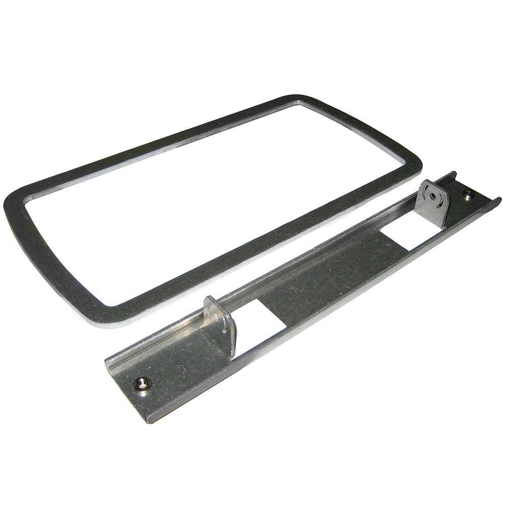
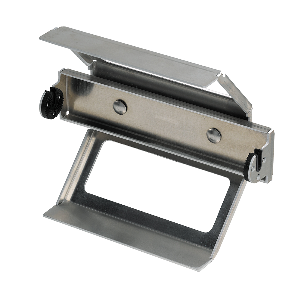
Humminbird IDMK H7R In-Dash Mounting Kit f/Helix 7
Humminbird IDMK H7R In-Dash Mounting Kit f/Helix 7
Online
$55.54for Each
Retail $69.42
Mfr PN: 740174-1
Stock: 4
|
IDMK H7R In-Dash Mounting Kit f/Helix 7 In Dash Mounting Kit for HELIX 7 Series
|
 WARNING: This product can expose you to chemicals including LEAD which is known to the State of California to cause cancer, birth defects or other reproductive harm. For more information go to
 Online
$55.54for Each
Retail $69.42
Mfr PN: 740174-1
Stock: 4
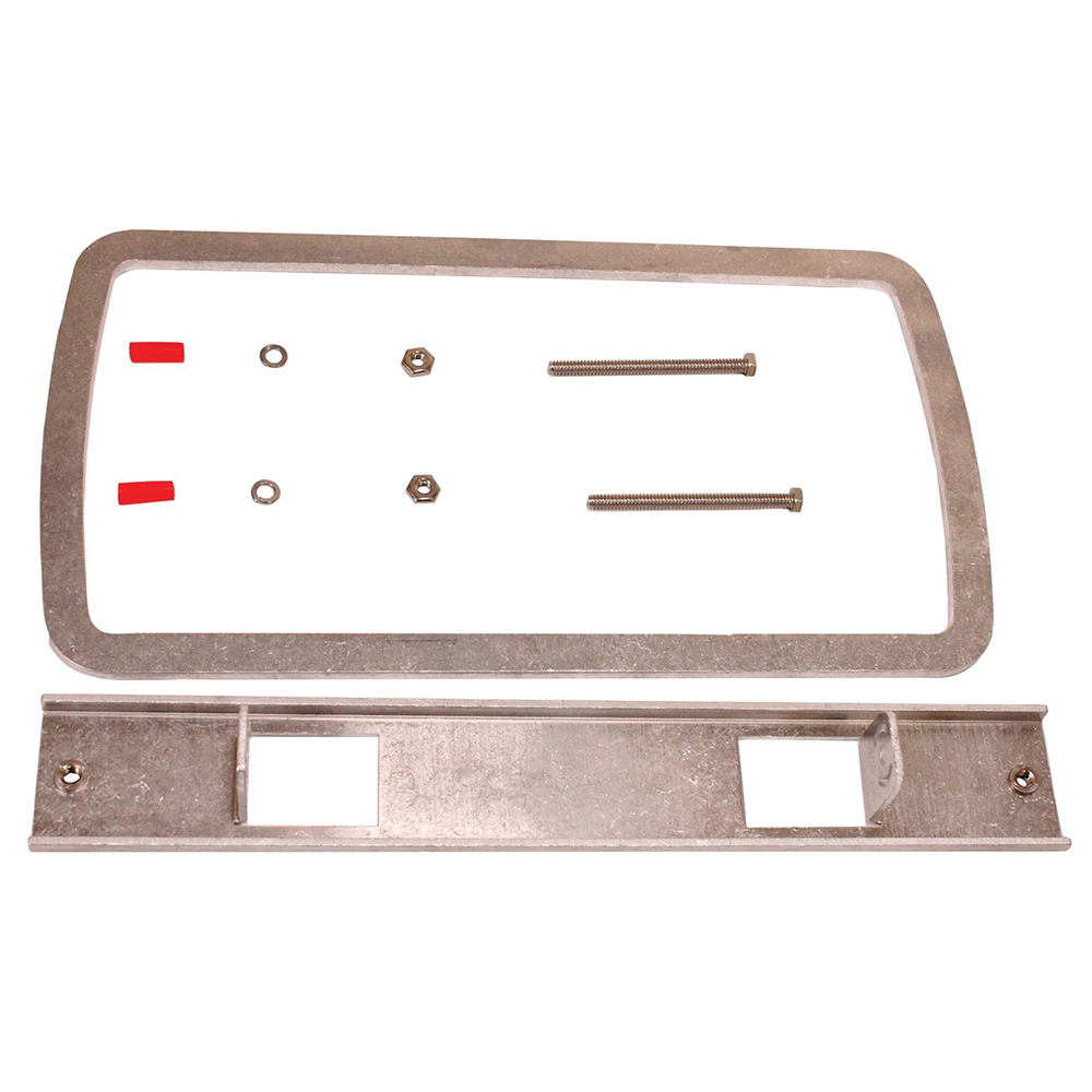
Humminbird IDMK H7R2 In-Dash Mounting Kit f/HELIX 7 G4
Humminbird IDMK H7R2 In-Dash Mounting Kit f/HELIX 7 G4
Online
$65.65for Each
Mfr PN: 740200-1
Stock: 4
|
IDMK H7R2 In-Dash Mounting Kit for HELIX 7 G4 The IDMK H7R2 is a rigid and reinforced in-dash mounting kit for HELIX 7 Series fish finders, complete with bracket and hardware. This provides a secure and finished look for the in-dash mounting of your Humminbird fishfinder. Compatible with:
In the Box:
*Sold as an Individual |
Online
$65.65for Each
Mfr PN: 740200-1
Stock: 4
Humminbird IDMK H910R In Dash Mounting Kit
Humminbird IDMK H910R In Dash Mounting Kit
Online
$60.60for Each
Retail $69.99
Mfr PN: 740155-1
Stock: 3
|
IDMK H910R In Dash Mounting Kit
For HELIX 9 & HELIX 10 series - All Models
|
Online
$60.60for Each
Retail $69.99
Mfr PN: 740155-1
Stock: 3

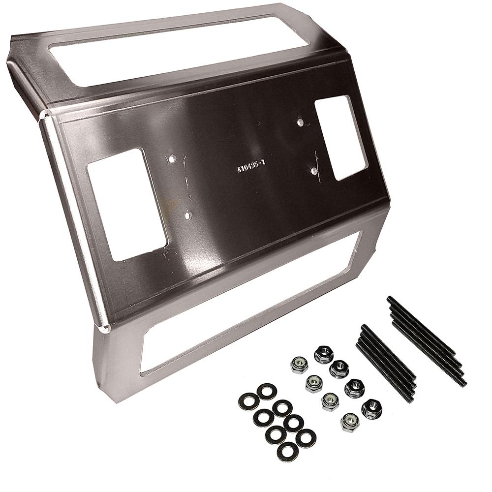
Humminbird IDMK S10 In-Dash Mounting Kit f/SOLIX 10
Humminbird IDMK S10 In-Dash Mounting Kit f/SOLIX 10
Online
$70.69for Each
Mfr PN: 740173-1
Stock: 2
|
IDMK S10 In-Dash Mounting Kit for SOLIX™ 10 In-Dash mounting kit for SOLIX™ 10 Models.
|
Online
$70.69for Each
Mfr PN: 740173-1
Stock: 2
Humminbird IDMK S12R In-Dash Mounting Kit f/SOLIX 12
Humminbird IDMK S12R In-Dash Mounting Kit f/SOLIX 12
Online
$70.69for Each
Retail $88.36
Mfr PN: 740176-1
Stock: 3
|
IDMK S12R In-Dash Mounting Kit for SOLIX 12 In-dash unit mounting kit for the SOLIX 12 Series of products.
|
Online
$70.69for Each
Retail $88.36
Mfr PN: 740176-1
Stock: 3
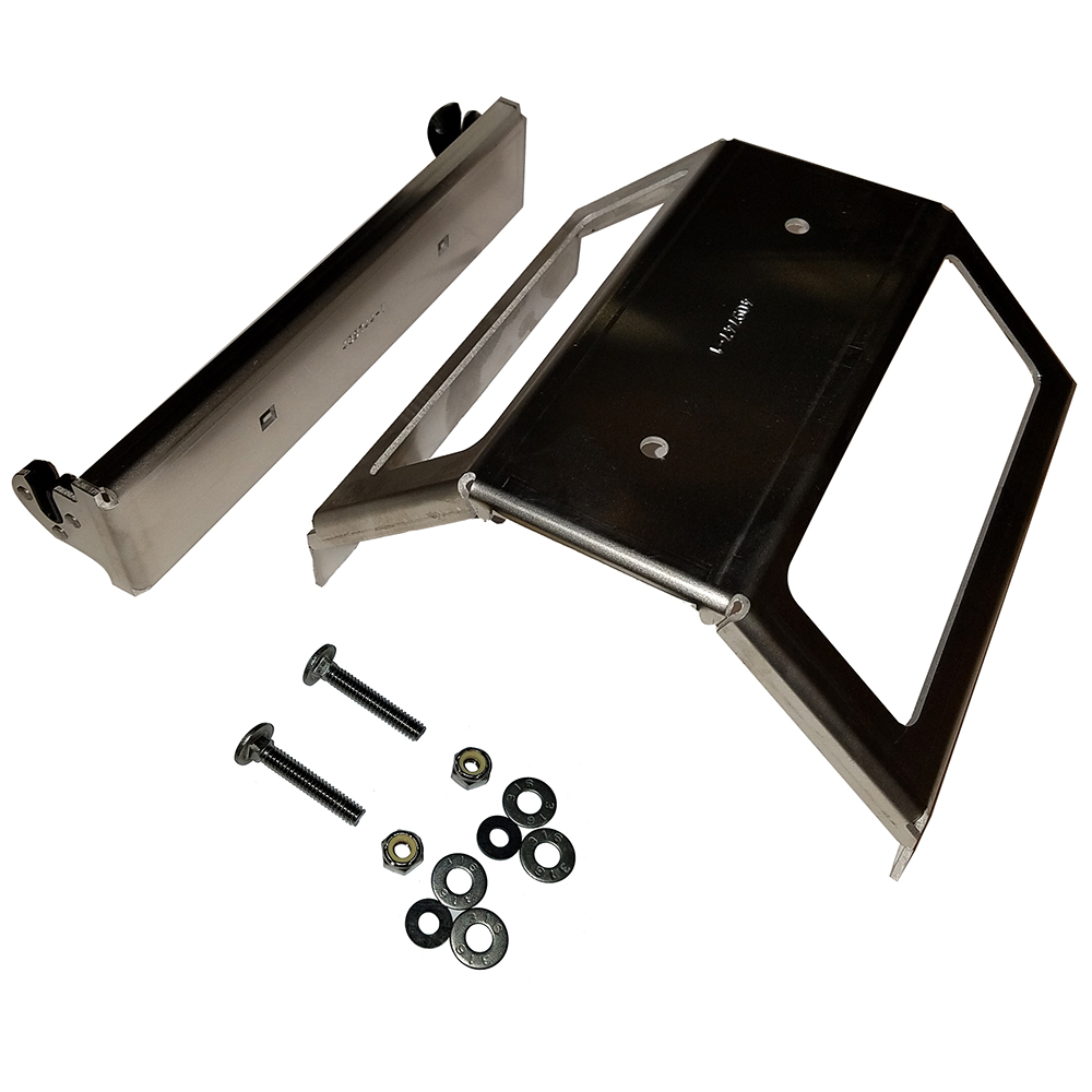
Humminbird IDMK-H89R Reinforced In-Dash Mounting Kit f/HELIX 8/9 G3
Humminbird IDMK-H89R Reinforced In-Dash Mounting Kit f/HELIX 8/9 G3
Online
$70.69for Each
Mfr PN: 740179-1
Stock: 3
|
IDMK-H89R Reinforced In-Dash Mounting Kit for HELIX® 8/9 G3 In-Dash Mounting Kit allows quick and easy, in-dash installation, with all necessary mounting hardware. Features:
|
Online
$70.69for Each
Mfr PN: 740179-1
Stock: 3
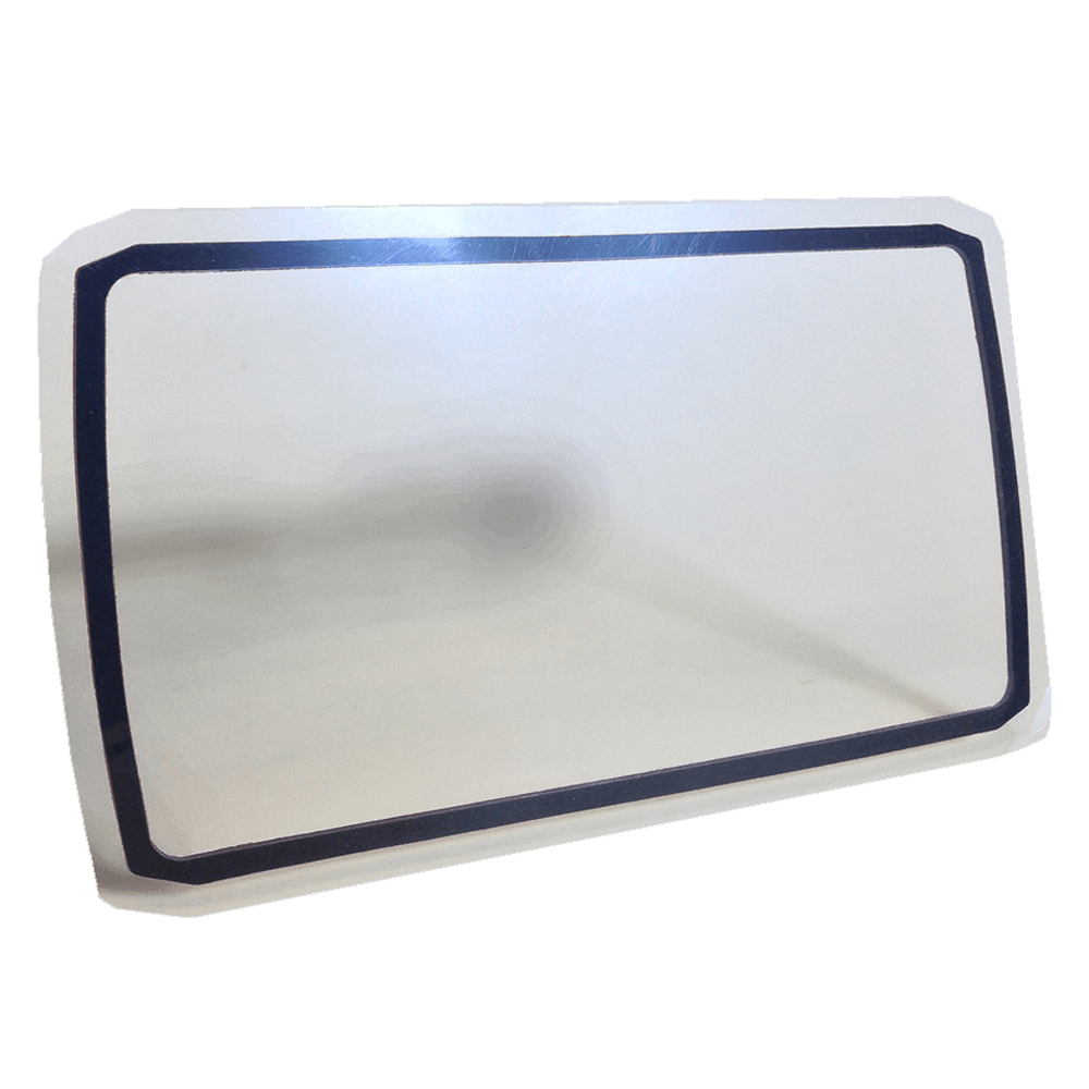
Humminbird IMDK H5 In Dash Mounting Kit f/HELIX 5 Series
Humminbird IMDK H5 In Dash Mounting Kit f/HELIX 5 Series
Online
$41.38for Each
Retail $44.99
Mfr PN: 740142-1
Stock: 2
|
IMDK H5 In Dash Mounting Kit for HELIX 5 Series The IDMK H5 is an in-dash mounting kit for HELIX 5 model fish finders. This provides what is needed to complete a secure and finished look for in-dash mounting of your Humminbird fish finder.
|
Online
$41.38for Each
Retail $44.99
Mfr PN: 740142-1
Stock: 2
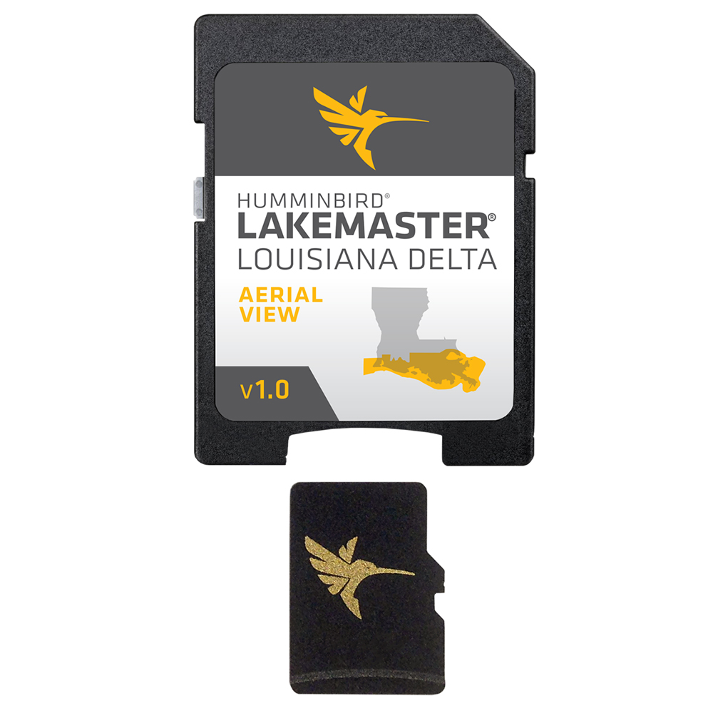
Humminbird LakeMaster Aerial Satellite View - Louisiana Delta
Humminbird LakeMaster Aerial Satellite View - Louisiana Delta
Online
$149.99for Each
Retail $149.99
Mfr PN: 600050-1
Stock: 20
|
LakeMaster Aerial Satellite View - Louisiana Delta
Humminbird® LakeMaster® now offers high resolution aerial photography of the Louisiana Delta on one micro card (with SD adaptor). Always know where you are with real life aerial views of shorelines, waterways, landmarks, obstructions, roads, marinas, canals, and channels. Also includes nav aids, lake names, points of interest and more!
|
Online
$149.99for Each
Retail $149.99
Mfr PN: 600050-1
Stock: 20
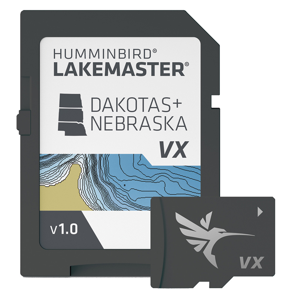
Humminbird LakeMaster VX - Dakotas/Nebraska
Humminbird LakeMaster VX - Dakotas/Nebraska
Online
$149.99for Each
Retail $149.99
Mfr PN: 601001-1
Stock: 6
|
LakeMaster® VX - Dakotas/Nebraska An upgraded mapping solution in Humminbird LakeMaster VX to help anglers understand what is under the water’s surface better than ever before. For decades, Humminbird LakeMaster® has led the charge with the most accurate and advanced mapping available for anglers. Now, LakeMaster is taking it to an entirely new level with the introduction of Humminbird LakeMaster maps with VX Technology. The LakeMaster name has been praised among anglers for having the highest quality mapping for fishing, often collected by a team of GIS analyst cartographers. Now with VX Technology, LakeMaster maps are packed with more information than ever before, including five new customizable color palettes, exceptional map performance, and a powerful combination of features. The LakeMaster lineup maintains the same regions as the current lineup, but now includes SmartStrike technology as a feature, allowing anglers to enter search parameters like season, time of day, temperature, and targeted fish species to create a custom chart that highlights areas of the map where fish are most likely to be biting. LakeMaster also includes customizable Chart Presets, Depth Highlight, Shallow Water Highlight, Water Level Offset, and One-Boat Network capability. LakeMaster has been the go-to road map for anglers, and compared to the competition, what you see on the map is actually on the lake bottom. With LakeMaster with VX Technology, Humminbird LakeMaster solidifies its place as the most accurate and detailed fishing map on the market. Features:
|
Online
$149.99for Each
Retail $149.99
Mfr PN: 601001-1
Stock: 6
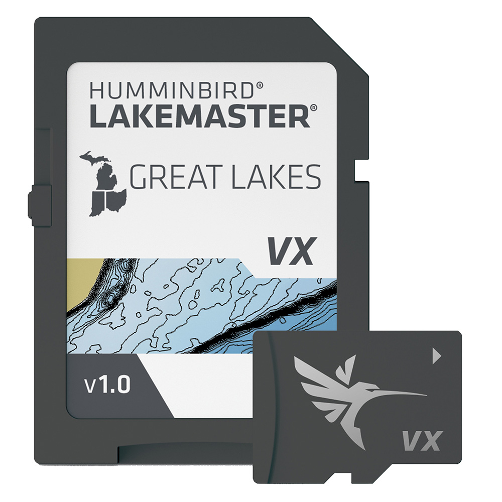
Humminbird LakeMaster VX - Great Lakes
Humminbird LakeMaster VX - Great Lakes
Online
$149.99for Each
Retail $149.99
Mfr PN: 601002-1
Stock: 13
|
LakeMaster® VX - Great Lakes An upgraded mapping solution in Humminbird LakeMaster VX to help anglers understand what is under the water’s surface better than ever before. For decades, Humminbird LakeMaster® has led the charge with the most accurate and advanced mapping available for anglers. Now, LakeMaster is taking it to an entirely new level with the introduction of Humminbird LakeMaster maps with VX Technology. The LakeMaster name has been praised among anglers for having the highest quality mapping for fishing, often collected by a team of GIS analyst cartographers. Now with VX Technology, LakeMaster maps are packed with more information than ever before, including five new customizable color palettes, exceptional map performance, and a powerful combination of features. The LakeMaster lineup maintains the same regions as the current lineup, but now includes SmartStrike technology as a feature, allowing anglers to enter search parameters like season, time of day, temperature, and targeted fish species to create a custom chart that highlights areas of the map where fish are most likely to be biting. LakeMaster also includes customizable Chart Presets, Depth Highlight, Shallow Water Highlight, Water Level Offset, and One-Boat Network capability. LakeMaster has been the go-to road map for anglers, and compared to the competition, what you see on the map is actually on the lake bottom. With LakeMaster with VX Technology, Humminbird LakeMaster solidifies its place as the most accurate and detailed fishing map on the market. Features:
|
Online
$149.99for Each
Retail $149.99
Mfr PN: 601002-1
Stock: 13
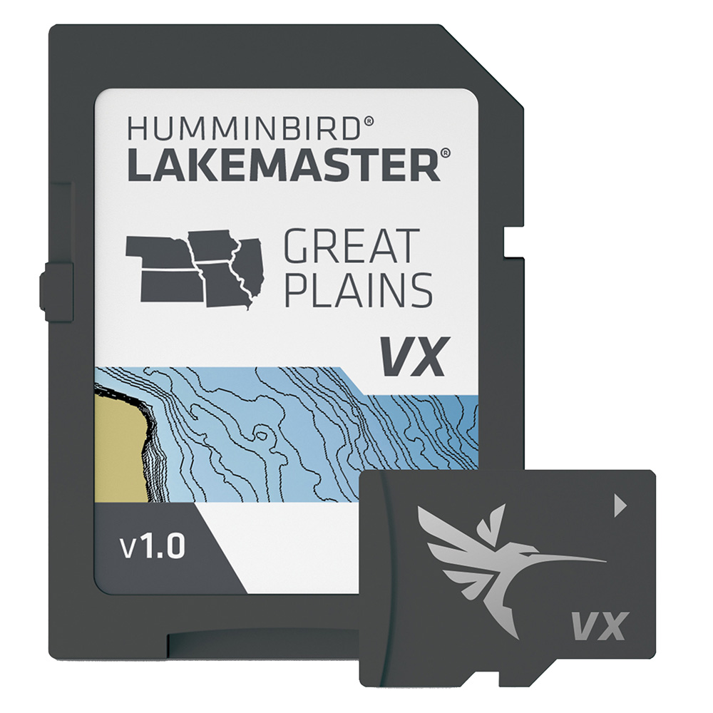
Humminbird LakeMaster VX - Great Plains
Humminbird LakeMaster VX - Great Plains
Online
$149.99for Each
Retail $149.99
Mfr PN: 601003-1
Stock: 4
|
LakeMaster® VX - Great Plains An upgraded mapping solution in Humminbird LakeMaster VX to help anglers understand what is under the water’s surface better than ever before. For decades, Humminbird LakeMaster® has led the charge with the most accurate and advanced mapping available for anglers. Now, LakeMaster is taking it to an entirely new level with the introduction of Humminbird LakeMaster maps with VX Technology. The LakeMaster name has been praised among anglers for having the highest quality mapping for fishing, often collected by a team of GIS analyst cartographers. Now with VX Technology, LakeMaster maps are packed with more information than ever before, including five new customizable color palettes, exceptional map performance, and a powerful combination of features. The LakeMaster lineup maintains the same regions as the current lineup, but now includes SmartStrike technology as a feature, allowing anglers to enter search parameters like season, time of day, temperature, and targeted fish species to create a custom chart that highlights areas of the map where fish are most likely to be biting. LakeMaster also includes customizable Chart Presets, Depth Highlight, Shallow Water Highlight, Water Level Offset, and One-Boat Network capability. LakeMaster has been the go-to road map for anglers, and compared to the competition, what you see on the map is actually on the lake bottom. With LakeMaster with VX Technology, Humminbird LakeMaster solidifies its place as the most accurate and detailed fishing map on the market. Features:
|
Online
$149.99for Each
Retail $149.99
Mfr PN: 601003-1
Stock: 4
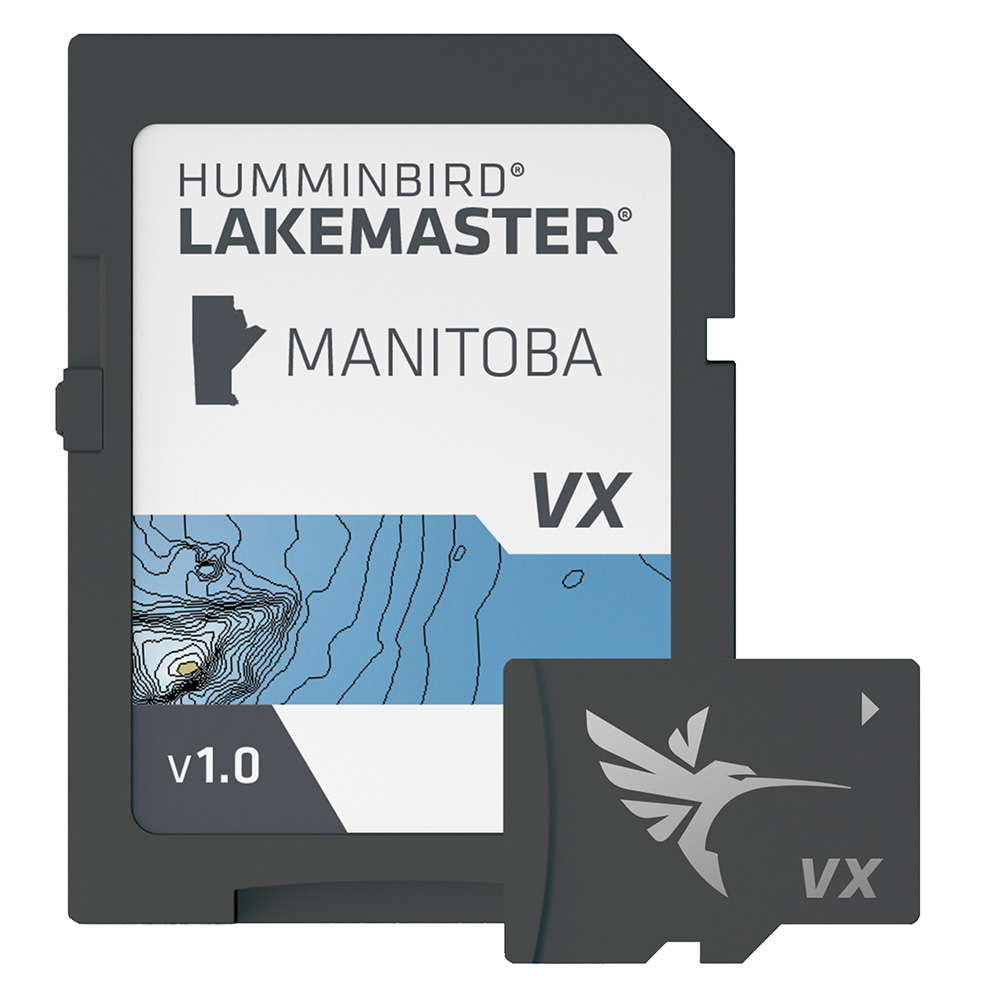
Humminbird LakeMaster VX - Manitoba
Humminbird LakeMaster VX - Manitoba
Online
$149.99for Each
Retail $149.99
Mfr PN: 601019-1
Stock: 2
|
LakeMaster® VX - Manitoba An upgraded mapping solution in Humminbird LakeMaster VX to help anglers understand what is under the water’s surface better than ever before. For decades, Humminbird LakeMaster® has led the charge with the most accurate and advanced mapping available for anglers. Now, LakeMaster is taking it to an entirely new level with the introduction of Humminbird LakeMaster maps with VX Technology. The LakeMaster name has been praised among anglers for having the highest quality mapping for fishing, often collected by a team of GIS analyst cartographers. Now with VX Technology, LakeMaster maps are packed with more information than ever before, including five new customizable color palettes, exceptional map performance, and a powerful combination of features. The LakeMaster lineup maintains the same regions as the current lineup, but now includes SmartStrike technology as a feature, allowing anglers to enter search parameters like season, time of day, temperature, and targeted fish species to create a custom chart that highlights areas of the map where fish are most likely to be biting. LakeMaster also includes customizable Chart Presets, Depth Highlight, Shallow Water Highlight, Water Level Offset, and One-Boat Network capability. LakeMaster has been the go-to road map for anglers, and compared to the competition, what you see on the map is actually on the lake bottom. With LakeMaster with VX Technology, Humminbird LakeMaster solidifies its place as the most accurate and detailed fishing map on the market. Features:
|
Online
$149.99for Each
Retail $149.99
Mfr PN: 601019-1
Stock: 2
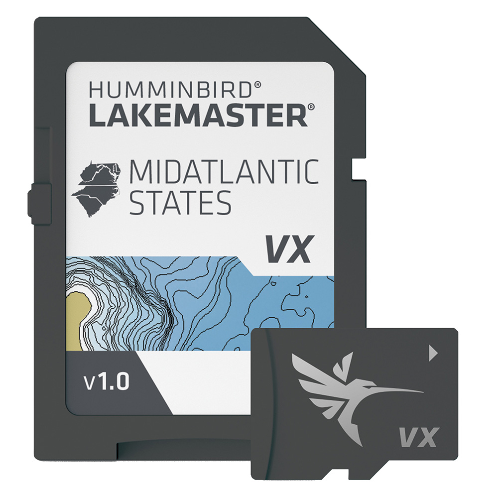
Humminbird LakeMaster VX - Mid-Atlantic States
Humminbird LakeMaster VX - Mid-Atlantic States
Online
$149.99for Each
Retail $149.99
Mfr PN: 601004-1
Stock: 36
|
LakeMaster® VX - Mid-Atlantic States An upgraded mapping solution in Humminbird LakeMaster VX to help anglers understand what is under the water’s surface better than ever before. For decades, Humminbird LakeMaster® has led the charge with the most accurate and advanced mapping available for anglers. Now, LakeMaster is taking it to an entirely new level with the introduction of Humminbird LakeMaster maps with VX Technology. The LakeMaster name has been praised among anglers for having the highest quality mapping for fishing, often collected by a team of GIS analyst cartographers. Now with VX Technology, LakeMaster maps are packed with more information than ever before, including five new customizable color palettes, exceptional map performance, and a powerful combination of features. The LakeMaster lineup maintains the same regions as the current lineup, but now includes SmartStrike technology as a feature, allowing anglers to enter search parameters like season, time of day, temperature, and targeted fish species to create a custom chart that highlights areas of the map where fish are most likely to be biting. LakeMaster also includes customizable Chart Presets, Depth Highlight, Shallow Water Highlight, Water Level Offset, and One-Boat Network capability. LakeMaster has been the go-to road map for anglers, and compared to the competition, what you see on the map is actually on the lake bottom. With LakeMaster with VX Technology, Humminbird LakeMaster solidifies its place as the most accurate and detailed fishing map on the market. Features:
|
Online
$149.99for Each
Retail $149.99
Mfr PN: 601004-1
Stock: 36
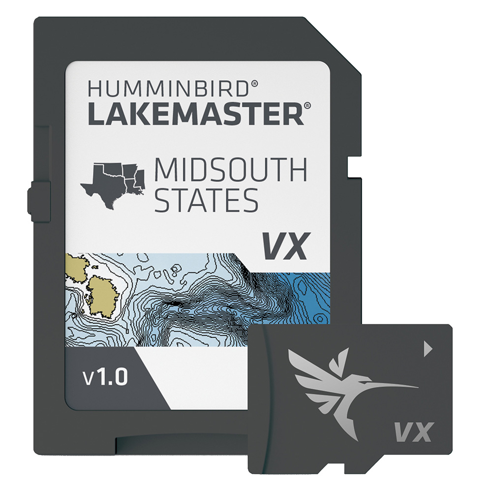
Humminbird LakeMaster VX - Mid-South States
Humminbird LakeMaster VX - Mid-South States
Online
$149.99for Each
Retail $149.99
Mfr PN: 601005-1
Stock: 16
|
LakeMaster® VX - Mid-South States An upgraded mapping solution in Humminbird LakeMaster VX to help anglers understand what is under the water’s surface better than ever before. For decades, Humminbird LakeMaster® has led the charge with the most accurate and advanced mapping available for anglers. Now, LakeMaster is taking it to an entirely new level with the introduction of Humminbird LakeMaster maps with VX Technology. The LakeMaster name has been praised among anglers for having the highest quality mapping for fishing, often collected by a team of GIS analyst cartographers. Now with VX Technology, LakeMaster maps are packed with more information than ever before, including five new customizable color palettes, exceptional map performance, and a powerful combination of features. The LakeMaster lineup maintains the same regions as the current lineup, but now includes SmartStrike technology as a feature, allowing anglers to enter search parameters like season, time of day, temperature, and targeted fish species to create a custom chart that highlights areas of the map where fish are most likely to be biting. LakeMaster also includes customizable Chart Presets, Depth Highlight, Shallow Water Highlight, Water Level Offset, and One-Boat Network capability. LakeMaster has been the go-to road map for anglers, and compared to the competition, what you see on the map is actually on the lake bottom. With LakeMaster with VX Technology, Humminbird LakeMaster solidifies its place as the most accurate and detailed fishing map on the market. Features:
|
Online
$149.99for Each
Retail $149.99
Mfr PN: 601005-1
Stock: 16
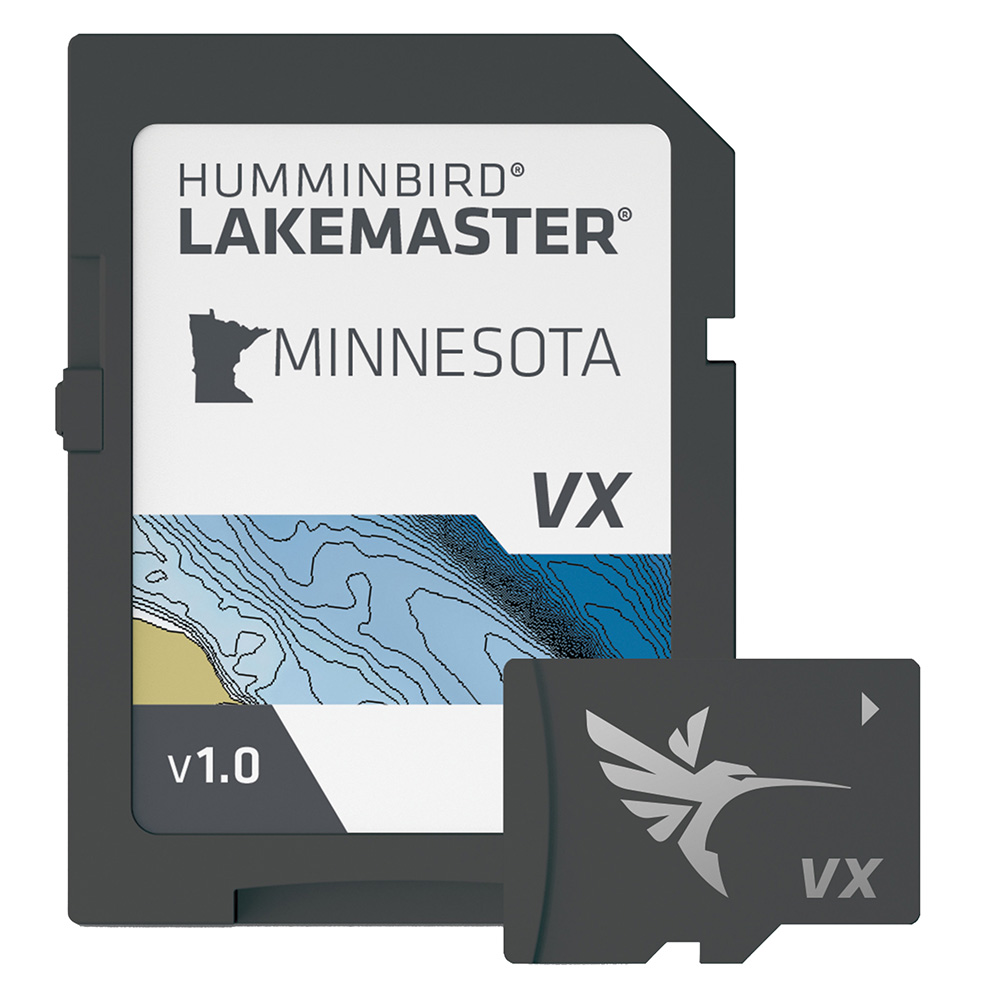
Humminbird LakeMaster VX - Minnesota
Humminbird LakeMaster VX - Minnesota
Online
$149.99for Each
Retail $149.99
Mfr PN: 601006-1
Stock: 54
|
LakeMaster® VX - Minnesota An upgraded mapping solution in Humminbird LakeMaster VX to help anglers understand what is under the water’s surface better than ever before. For decades, Humminbird LakeMaster® has led the charge with the most accurate and advanced mapping available for anglers. Now, LakeMaster is taking it to an entirely new level with the introduction of Humminbird LakeMaster maps with VX Technology. The LakeMaster name has been praised among anglers for having the highest quality mapping for fishing, often collected by a team of GIS analyst cartographers. Now with VX Technology, LakeMaster maps are packed with more information than ever before, including five new customizable color palettes, exceptional map performance, and a powerful combination of features. The LakeMaster lineup maintains the same regions as the current lineup, but now includes SmartStrike technology as a feature, allowing anglers to enter search parameters like season, time of day, temperature, and targeted fish species to create a custom chart that highlights areas of the map where fish are most likely to be biting. LakeMaster also includes customizable Chart Presets, Depth Highlight, Shallow Water Highlight, Water Level Offset, and One-Boat Network capability. LakeMaster has been the go-to road map for anglers, and compared to the competition, what you see on the map is actually on the lake bottom. With LakeMaster with VX Technology, Humminbird LakeMaster solidifies its place as the most accurate and detailed fishing map on the market. Features:
|
Online
$149.99for Each
Retail $149.99
Mfr PN: 601006-1
Stock: 54
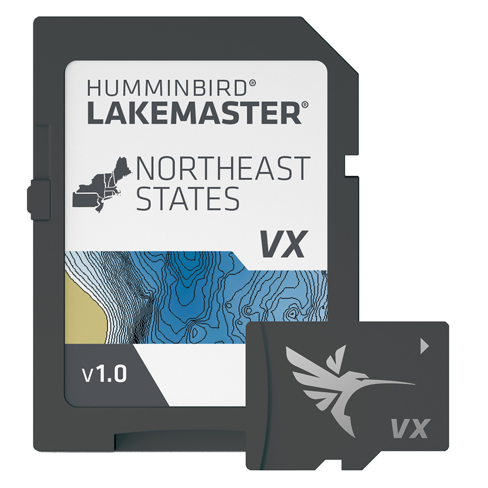
Humminbird LakeMaster VX - Northeast States
Humminbird LakeMaster VX - Northeast States
Online
$149.99for Each
Retail $149.99
Mfr PN: 601007-1
Stock: 42
|
LakeMaster® VX - Northeast States An upgraded mapping solution in Humminbird LakeMaster VX to help anglers understand what is under the water’s surface better than ever before. For decades, Humminbird LakeMaster® has led the charge with the most accurate and advanced mapping available for anglers. Now, LakeMaster is taking it to an entirely new level with the introduction of Humminbird LakeMaster maps with VX Technology. The LakeMaster name has been praised among anglers for having the highest quality mapping for fishing, often collected by a team of GIS analyst cartographers. Now with VX Technology, LakeMaster maps are packed with more information than ever before, including five new customizable color palettes, exceptional map performance, and a powerful combination of features. The LakeMaster lineup maintains the same regions as the current lineup, but now includes SmartStrike technology as a feature, allowing anglers to enter search parameters like season, time of day, temperature, and targeted fish species to create a custom chart that highlights areas of the map where fish are most likely to be biting. LakeMaster also includes customizable Chart Presets, Depth Highlight, Shallow Water Highlight, Water Level Offset, and One-Boat Network capability. LakeMaster has been the go-to road map for anglers, and compared to the competition, what you see on the map is actually on the lake bottom. With LakeMaster with VX Technology, Humminbird LakeMaster solidifies its place as the most accurate and detailed fishing map on the market. Features:
|
Online
$149.99for Each
Retail $149.99
Mfr PN: 601007-1
Stock: 42
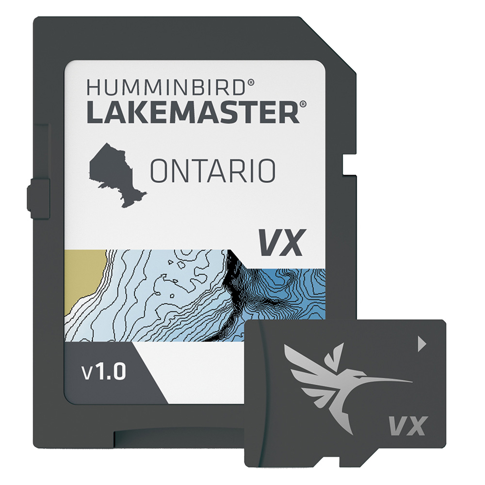
Humminbird LakeMaster VX - Ontario
Humminbird LakeMaster VX - Ontario
Online
$149.99for Each
Retail $149.99
Mfr PN: 601020-1
Stock: 69
|
LakeMaster® VX - Ontario An upgraded mapping solution in Humminbird LakeMaster VX to help anglers understand what is under the water’s surface better than ever before. For decades, Humminbird LakeMaster® has led the charge with the most accurate and advanced mapping available for anglers. Now, LakeMaster is taking it to an entirely new level with the introduction of Humminbird LakeMaster maps with VX Technology. The LakeMaster name has been praised among anglers for having the highest quality mapping for fishing, often collected by a team of GIS analyst cartographers. Now with VX Technology, LakeMaster maps are packed with more information than ever before, including five new customizable color palettes, exceptional map performance, and a powerful combination of features. The LakeMaster lineup maintains the same regions as the current lineup, but now includes SmartStrike technology as a feature, allowing anglers to enter search parameters like season, time of day, temperature, and targeted fish species to create a custom chart that highlights areas of the map where fish are most likely to be biting. LakeMaster also includes customizable Chart Presets, Depth Highlight, Shallow Water Highlight, Water Level Offset, and One-Boat Network capability. LakeMaster has been the go-to road map for anglers, and compared to the competition, what you see on the map is actually on the lake bottom. With LakeMaster with VX Technology, Humminbird LakeMaster solidifies its place as the most accurate and detailed fishing map on the market. Features:
|
Online
$149.99for Each
Retail $149.99
Mfr PN: 601020-1
Stock: 69
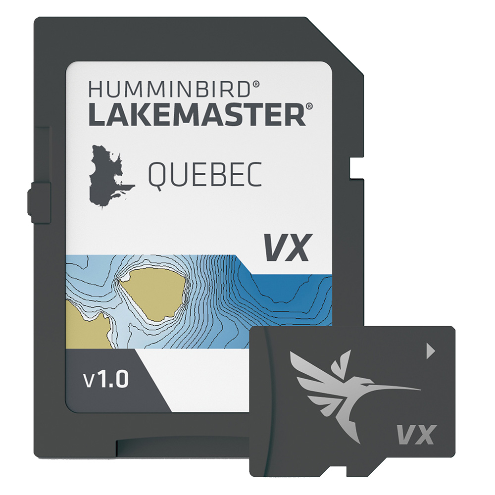
Humminbird LakeMaster VX - Quebec
Humminbird LakeMaster VX - Quebec
Online
$149.99for Each
Retail $149.99
Mfr PN: 601021-1
Stock: 6
|
LakeMaster® VX - Quebec An upgraded mapping solution in Humminbird LakeMaster VX to help anglers understand what is under the water’s surface better than ever before. For decades, Humminbird LakeMaster® has led the charge with the most accurate and advanced mapping available for anglers. Now, LakeMaster is taking it to an entirely new level with the introduction of Humminbird LakeMaster maps with VX Technology. The LakeMaster name has been praised among anglers for having the highest quality mapping for fishing, often collected by a team of GIS analyst cartographers. Now with VX Technology, LakeMaster maps are packed with more information than ever before, including five new customizable color palettes, exceptional map performance, and a powerful combination of features. The LakeMaster lineup maintains the same regions as the current lineup, but now includes SmartStrike technology as a feature, allowing anglers to enter search parameters like season, time of day, temperature, and targeted fish species to create a custom chart that highlights areas of the map where fish are most likely to be biting. LakeMaster also includes customizable Chart Presets, Depth Highlight, Shallow Water Highlight, Water Level Offset, and One-Boat Network capability. LakeMaster has been the go-to road map for anglers, and compared to the competition, what you see on the map is actually on the lake bottom. With LakeMaster with VX Technology, Humminbird LakeMaster solidifies its place as the most accurate and detailed fishing map on the market. Features:
|
Online
$149.99for Each
Retail $149.99
Mfr PN: 601021-1
Stock: 6
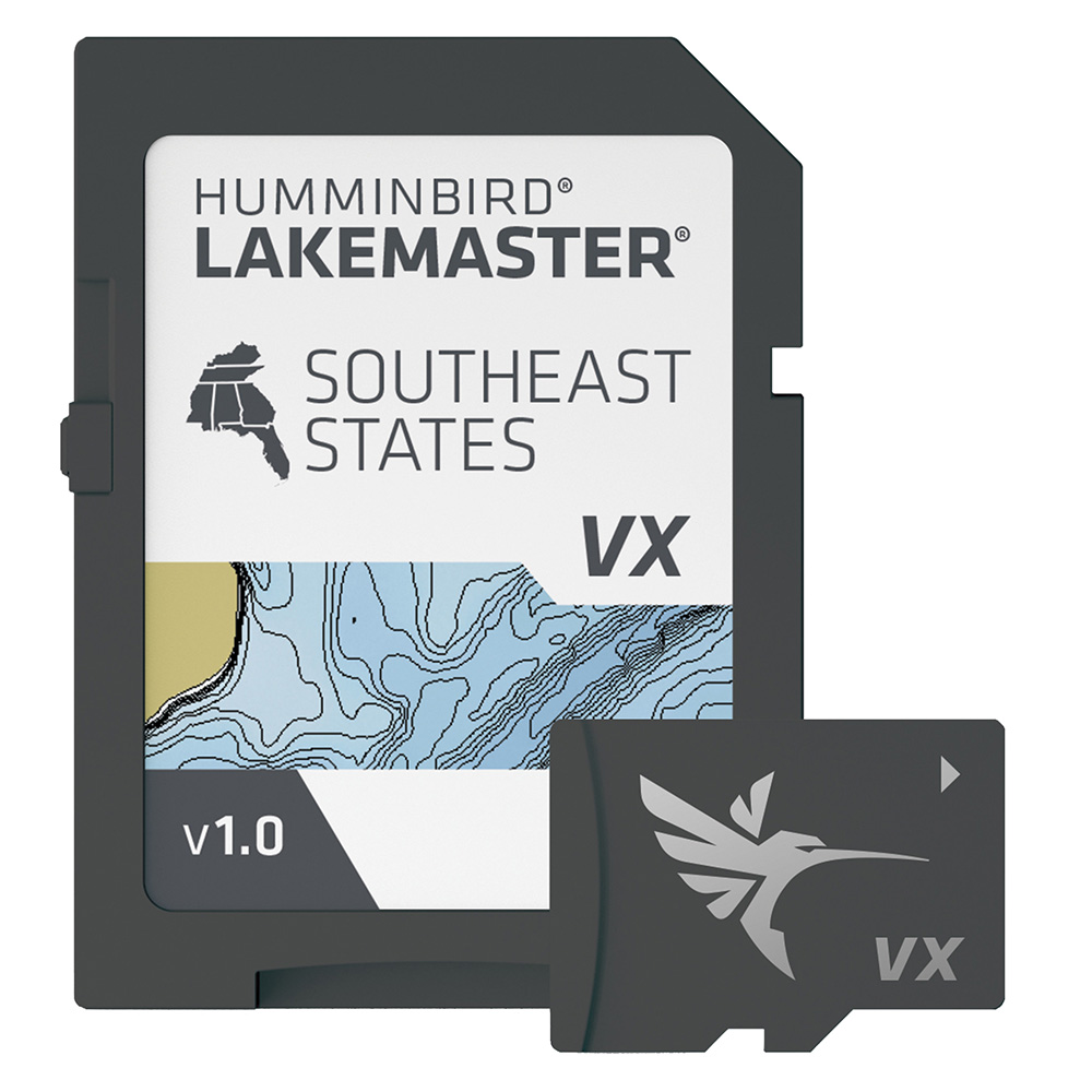
Humminbird LakeMaster VX - Southeast States
Humminbird LakeMaster VX - Southeast States
Online
$149.99for Each
Retail $149.99
Mfr PN: 601008-1
Stock: 7
|
LakeMaster® VX - Southeast States An upgraded mapping solution in Humminbird LakeMaster VX to help anglers understand what is under the water’s surface better than ever before. For decades, Humminbird LakeMaster® has led the charge with the most accurate and advanced mapping available for anglers. Now, LakeMaster is taking it to an entirely new level with the introduction of Humminbird LakeMaster maps with VX Technology. The LakeMaster name has been praised among anglers for having the highest quality mapping for fishing, often collected by a team of GIS analyst cartographers. Now with VX Technology, LakeMaster maps are packed with more information than ever before, including five new customizable color palettes, exceptional map performance, and a powerful combination of features. The LakeMaster lineup maintains the same regions as the current lineup, but now includes SmartStrike technology as a feature, allowing anglers to enter search parameters like season, time of day, temperature, and targeted fish species to create a custom chart that highlights areas of the map where fish are most likely to be biting. LakeMaster also includes customizable Chart Presets, Depth Highlight, Shallow Water Highlight, Water Level Offset, and One-Boat Network capability. LakeMaster has been the go-to road map for anglers, and compared to the competition, what you see on the map is actually on the lake bottom. With LakeMaster with VX Technology, Humminbird LakeMaster solidifies its place as the most accurate and detailed fishing map on the market. Features:
|
Online
$149.99for Each
Retail $149.99
Mfr PN: 601008-1
Stock: 7
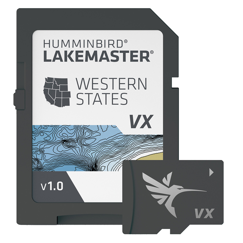
Humminbird LakeMaster VX - Western States
Humminbird LakeMaster VX - Western States
Online
$149.99for Each
Retail $149.99
Mfr PN: 601009-1
Stock: 16
|
LakeMaster® VX - Western States An upgraded mapping solution in Humminbird LakeMaster VX to help anglers understand what is under the water’s surface better than ever before. For decades, Humminbird LakeMaster® has led the charge with the most accurate and advanced mapping available for anglers. Now, LakeMaster is taking it to an entirely new level with the introduction of Humminbird LakeMaster maps with VX Technology. The LakeMaster name has been praised among anglers for having the highest quality mapping for fishing, often collected by a team of GIS analyst cartographers. Now with VX Technology, LakeMaster maps are packed with more information than ever before, including five new customizable color palettes, exceptional map performance, and a powerful combination of features. The LakeMaster lineup maintains the same regions as the current lineup, but now includes SmartStrike technology as a feature, allowing anglers to enter search parameters like season, time of day, temperature, and targeted fish species to create a custom chart that highlights areas of the map where fish are most likely to be biting. LakeMaster also includes customizable Chart Presets, Depth Highlight, Shallow Water Highlight, Water Level Offset, and One-Boat Network capability. LakeMaster has been the go-to road map for anglers, and compared to the competition, what you see on the map is actually on the lake bottom. With LakeMaster with VX Technology, Humminbird LakeMaster solidifies its place as the most accurate and detailed fishing map on the market. Features:
|
Online
$149.99for Each
Retail $149.99
Mfr PN: 601009-1
Stock: 16
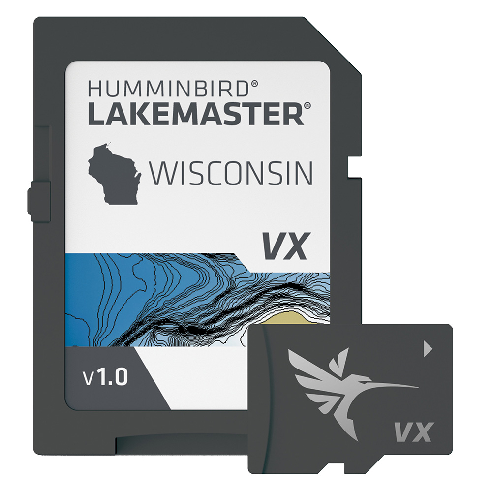
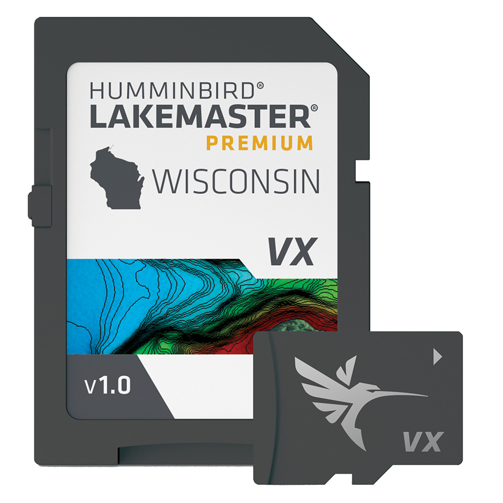
Humminbird LakeMaster VX - Wisconsin
Humminbird LakeMaster VX - Wisconsin
Online
$149.99for Each
Retail $149.99
Mfr PN: 601010-1
Stock: 28
|
LakeMaster® VX - Wisconsin An upgraded mapping solution in Humminbird LakeMaster VX to help anglers understand what is under the water’s surface better than ever before. For decades, Humminbird LakeMaster® has led the charge with the most accurate and advanced mapping available for anglers. Now, LakeMaster is taking it to an entirely new level with the introduction of Humminbird LakeMaster maps with VX Technology. The LakeMaster name has been praised among anglers for having the highest quality mapping for fishing, often collected by a team of GIS analyst cartographers. Now with VX Technology, LakeMaster maps are packed with more information than ever before, including five new customizable color palettes, exceptional map performance, and a powerful combination of features. The LakeMaster lineup maintains the same regions as the current lineup, but now includes SmartStrike technology as a feature, allowing anglers to enter search parameters like season, time of day, temperature, and targeted fish species to create a custom chart that highlights areas of the map where fish are most likely to be biting. LakeMaster also includes customizable Chart Presets, Depth Highlight, Shallow Water Highlight, Water Level Offset, and One-Boat Network capability. LakeMaster has been the go-to road map for anglers, and compared to the competition, what you see on the map is actually on the lake bottom. With LakeMaster with VX Technology, Humminbird LakeMaster solidifies its place as the most accurate and detailed fishing map on the market. Features:
|
Online
$149.99for Each
Retail $149.99
Mfr PN: 601010-1
Stock: 28
Humminbird LakeMaster VX Premium - Dakota/Nebraska
Humminbird LakeMaster VX Premium - Dakota/Nebraska
Online
$199.99for Each
Retail $199.99
Mfr PN: 602001-1
Stock: 0
|
LakeMaster® VX Premium - Dakota/Nebraska An upgraded premium mapping solution in Humminbird LakeMaster VX to help anglers understand what is under the water’s surface better than ever before. For decades, Humminbird LakeMaster® has led the charge with the most accurate and advanced mapping available for anglers. Now, LakeMaster is taking it to an entirely new level with the introduction of Humminbird LakeMaster maps with VX Technology. The LakeMaster name has been praised among anglers for having the highest quality mapping for fishing, often collected by a team of GIS analyst cartographers. Now with VX Technology, LakeMaster maps are packed with more information than ever before, including five new customizable color palettes, exceptional map performance, and a powerful combination of features. The LakeMaster lineup maintains the same regions as the current lineup, but with two options per region: LakeMaster and LakeMaster Premium. Both products now include SmartStrike technology as a feature, allowing anglers to enter search parameters like season, time of day, temperature, and targeted fish species to create a custom chart that highlights areas of the map where fish are most likely to be biting. LakeMaster and LakeMaster Premium also include customizable Chart Presets, Depth Highlight, Shallow Water Highlight, Water Level Offset, and One-Boat Network capability. And for an added advantage, LakeMaster Premium includes two additional features: 2D Shaded Relief and Aerial Imagery. LakeMaster has been the go-to road map for anglers, and compared to the competition, what you see on the map is actually on the lake bottom. With LakeMaster with VX Technology, Humminbird LakeMaster solidifies its place as the most accurate and detailed fishing map on the market. Features:
|
Online
$199.99for Each
Retail $199.99
Mfr PN: 602001-1
Stock: 0
Humminbird LakeMaster VX Premium - Great Plains
Humminbird LakeMaster VX Premium - Great Plains
Online
$199.99for Each
Retail $199.99
Mfr PN: 602003-1
Stock: 12
|
LakeMaster® VX Premium - Great Plains An upgraded premium mapping solution in Humminbird LakeMaster VX to help anglers understand what is under the water’s surface better than ever before. For decades, Humminbird LakeMaster® has led the charge with the most accurate and advanced mapping available for anglers. Now, LakeMaster is taking it to an entirely new level with the introduction of Humminbird LakeMaster maps with VX Technology. The LakeMaster name has been praised among anglers for having the highest quality mapping for fishing, often collected by a team of GIS analyst cartographers. Now with VX Technology, LakeMaster maps are packed with more information than ever before, including five new customizable color palettes, exceptional map performance, and a powerful combination of features. The LakeMaster lineup maintains the same regions as the current lineup, but with two options per region: LakeMaster and LakeMaster Premium. Both products now include SmartStrike technology as a feature, allowing anglers to enter search parameters like season, time of day, temperature, and targeted fish species to create a custom chart that highlights areas of the map where fish are most likely to be biting. LakeMaster and LakeMaster Premium also include customizable Chart Presets, Depth Highlight, Shallow Water Highlight, Water Level Offset, and One-Boat Network capability. And for an added advantage, LakeMaster Premium includes two additional features: 2D Shaded Relief and Aerial Imagery. LakeMaster has been the go-to road map for anglers, and compared to the competition, what you see on the map is actually on the lake bottom. With LakeMaster with VX Technology, Humminbird LakeMaster solidifies its place as the most accurate and detailed fishing map on the market. Features:
|
Online
$199.99for Each
Retail $199.99
Mfr PN: 602003-1
Stock: 12
Humminbird LakeMaster VX Premium - Manitoba
Humminbird LakeMaster VX Premium - Manitoba
Online
$199.99for Each
Retail $199.99
Mfr PN: 602019-1
Stock: 5
|
LakeMaster® VX Premium - Manitoba An upgraded premium mapping solution in Humminbird LakeMaster VX to help anglers understand what is under the water’s surface better than ever before. For decades, Humminbird LakeMaster® has led the charge with the most accurate and advanced mapping available for anglers. Now, LakeMaster is taking it to an entirely new level with the introduction of Humminbird LakeMaster maps with VX Technology. The LakeMaster name has been praised among anglers for having the highest quality mapping for fishing, often collected by a team of GIS analyst cartographers. Now with VX Technology, LakeMaster maps are packed with more information than ever before, including five new customizable color palettes, exceptional map performance, and a powerful combination of features. The LakeMaster lineup maintains the same regions as the current lineup, but with two options per region: LakeMaster and LakeMaster Premium. Both products now include SmartStrike technology as a feature, allowing anglers to enter search parameters like season, time of day, temperature, and targeted fish species to create a custom chart that highlights areas of the map where fish are most likely to be biting. LakeMaster and LakeMaster Premium also include customizable Chart Presets, Depth Highlight, Shallow Water Highlight, Water Level Offset, and One-Boat Network capability. And for an added advantage, LakeMaster Premium includes two additional features: 2D Shaded Relief and Aerial Imagery. LakeMaster has been the go-to road map for anglers, and compared to the competition, what you see on the map is actually on the lake bottom. With LakeMaster with VX Technology, Humminbird LakeMaster solidifies its place as the most accurate and detailed fishing map on the market. Features:
|
Online
$199.99for Each
Retail $199.99
Mfr PN: 602019-1
Stock: 5
Humminbird LakeMaster VX Premium - Mid-South States
Humminbird LakeMaster VX Premium - Mid-South States
Online
$199.99for Each
Retail $199.99
Mfr PN: 602005-1
Stock: 58
|
LakeMaster® VX Premium - Mid-South States An upgraded premium mapping solution in Humminbird LakeMaster VX to help anglers understand what is under the water’s surface better than ever before. For decades, Humminbird LakeMaster® has led the charge with the most accurate and advanced mapping available for anglers. Now, LakeMaster is taking it to an entirely new level with the introduction of Humminbird LakeMaster maps with VX Technology. The LakeMaster name has been praised among anglers for having the highest quality mapping for fishing, often collected by a team of GIS analyst cartographers. Now with VX Technology, LakeMaster maps are packed with more information than ever before, including five new customizable color palettes, exceptional map performance, and a powerful combination of features. The LakeMaster lineup maintains the same regions as the current lineup, but with two options per region: LakeMaster and LakeMaster Premium. Both products now include SmartStrike technology as a feature, allowing anglers to enter search parameters like season, time of day, temperature, and targeted fish species to create a custom chart that highlights areas of the map where fish are most likely to be biting. LakeMaster and LakeMaster Premium also include customizable Chart Presets, Depth Highlight, Shallow Water Highlight, Water Level Offset, and One-Boat Network capability. And for an added advantage, LakeMaster Premium includes two additional features: 2D Shaded Relief and Aerial Imagery. LakeMaster has been the go-to road map for anglers, and compared to the competition, what you see on the map is actually on the lake bottom. With LakeMaster with VX Technology, Humminbird LakeMaster solidifies its place as the most accurate and detailed fishing map on the market. Features:
|
Online
$199.99for Each
Retail $199.99
Mfr PN: 602005-1
Stock: 58
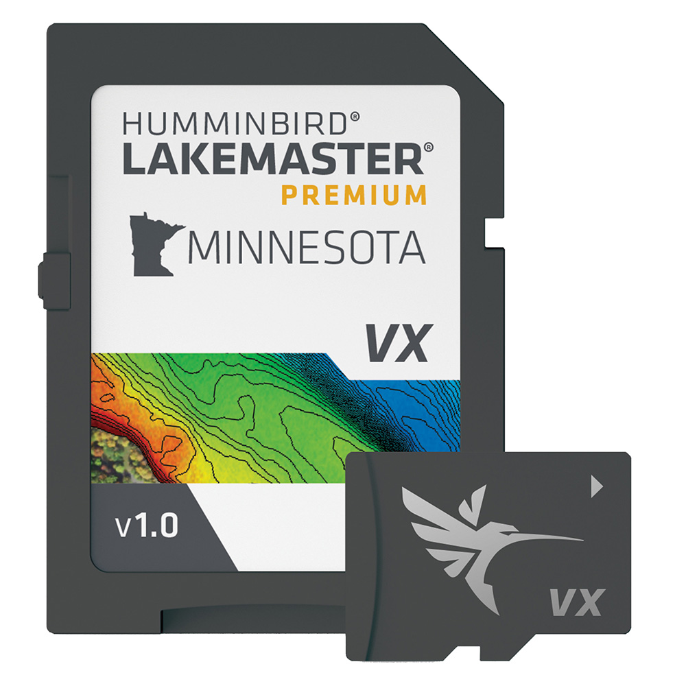
Humminbird LakeMaster VX Premium - Minnesota
Humminbird LakeMaster VX Premium - Minnesota
Online
$199.99for Each
Retail $199.99
Mfr PN: 602006-1
Stock: 0
|
LakeMaster® VX Premium - Minnesota An upgraded premium mapping solution in Humminbird LakeMaster VX to help anglers understand what is under the water’s surface better than ever before. For decades, Humminbird LakeMaster® has led the charge with the most accurate and advanced mapping available for anglers. Now, LakeMaster is taking it to an entirely new level with the introduction of Humminbird LakeMaster maps with VX Technology. The LakeMaster name has been praised among anglers for having the highest quality mapping for fishing, often collected by a team of GIS analyst cartographers. Now with VX Technology, LakeMaster maps are packed with more information than ever before, including five new customizable color palettes, exceptional map performance, and a powerful combination of features. The LakeMaster lineup maintains the same regions as the current lineup, but with two options per region: LakeMaster and LakeMaster Premium. Both products now include SmartStrike technology as a feature, allowing anglers to enter search parameters like season, time of day, temperature, and targeted fish species to create a custom chart that highlights areas of the map where fish are most likely to be biting. LakeMaster and LakeMaster Premium also include customizable Chart Presets, Depth Highlight, Shallow Water Highlight, Water Level Offset, and One-Boat Network capability. And for an added advantage, LakeMaster Premium includes two additional features: 2D Shaded Relief and Aerial Imagery. LakeMaster has been the go-to road map for anglers, and compared to the competition, what you see on the map is actually on the lake bottom. With LakeMaster with VX Technology, Humminbird LakeMaster solidifies its place as the most accurate and detailed fishing map on the market. Features:
|
Online
$199.99for Each
Retail $199.99
Mfr PN: 602006-1
Stock: 0
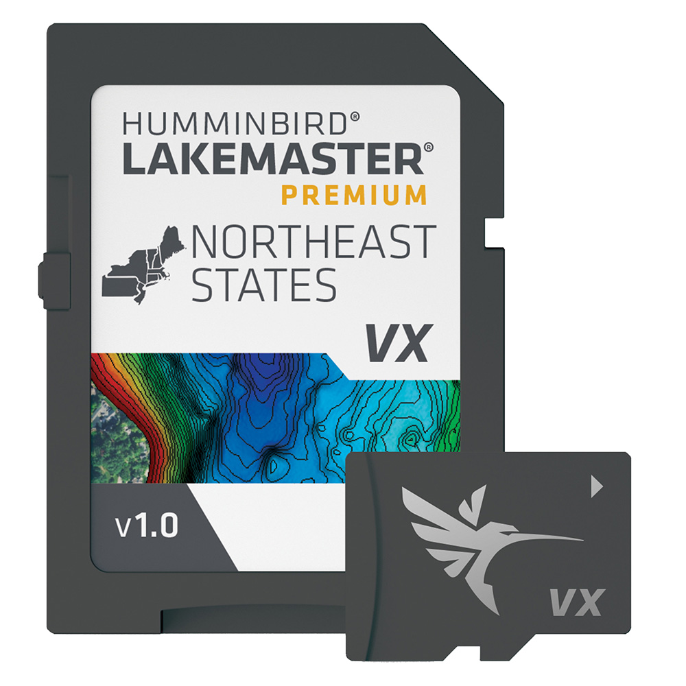
Humminbird LakeMaster VX Premium - Northeast
Humminbird LakeMaster VX Premium - Northeast
Online
$199.99for Each
Retail $199.99
Mfr PN: 602007-1
Stock: 10
|
LakeMaster® VX Premium - Northeast An upgraded premium mapping solution in Humminbird LakeMaster VX to help anglers understand what is under the water’s surface better than ever before. For decades, Humminbird LakeMaster® has led the charge with the most accurate and advanced mapping available for anglers. Now, LakeMaster is taking it to an entirely new level with the introduction of Humminbird LakeMaster maps with VX Technology. The LakeMaster name has been praised among anglers for having the highest quality mapping for fishing, often collected by a team of GIS analyst cartographers. Now with VX Technology, LakeMaster maps are packed with more information than ever before, including five new customizable color palettes, exceptional map performance, and a powerful combination of features. The LakeMaster lineup maintains the same regions as the current lineup, but with two options per region: LakeMaster and LakeMaster Premium. Both products now include SmartStrike technology as a feature, allowing anglers to enter search parameters like season, time of day, temperature, and targeted fish species to create a custom chart that highlights areas of the map where fish are most likely to be biting. LakeMaster and LakeMaster Premium also include customizable Chart Presets, Depth Highlight, Shallow Water Highlight, Water Level Offset, and One-Boat Network capability. And for an added advantage, LakeMaster Premium includes two additional features: 2D Shaded Relief and Aerial Imagery. LakeMaster has been the go-to road map for anglers, and compared to the competition, what you see on the map is actually on the lake bottom. With LakeMaster with VX Technology, Humminbird LakeMaster solidifies its place as the most accurate and detailed fishing map on the market. Features:
|
Online
$199.99for Each
Retail $199.99
Mfr PN: 602007-1
Stock: 10
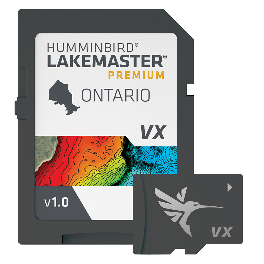
Humminbird LakeMaster VX Premium - Ontario
Humminbird LakeMaster VX Premium - Ontario
Online
$249.99for Each
Retail $249.99
Mfr PN: 602020-1
Stock: 171
|
LakeMaster® VX Premium - Ontario An upgraded premium mapping solution in Humminbird LakeMaster VX to help anglers understand what is under the water’s surface better than ever before. For decades, Humminbird LakeMaster® has led the charge with the most accurate and advanced mapping available for anglers. Now, LakeMaster is taking it to an entirely new level with the introduction of Humminbird LakeMaster maps with VX Technology. The LakeMaster name has been praised among anglers for having the highest quality mapping for fishing, often collected by a team of GIS analyst cartographers. Now with VX Technology, LakeMaster maps are packed with more information than ever before, including five new customizable color palettes, exceptional map performance, and a powerful combination of features. The LakeMaster lineup maintains the same regions as the current lineup, but with two options per region: LakeMaster and LakeMaster Premium. Both products now include SmartStrike technology as a feature, allowing anglers to enter search parameters like season, time of day, temperature, and targeted fish species to create a custom chart that highlights areas of the map where fish are most likely to be biting. LakeMaster and LakeMaster Premium also include customizable Chart Presets, Depth Highlight, Shallow Water Highlight, Water Level Offset, and One-Boat Network capability. And for an added advantage, LakeMaster Premium includes two additional features: 2D Shaded Relief and Aerial Imagery. LakeMaster has been the go-to road map for anglers, and compared to the competition, what you see on the map is actually on the lake bottom. With LakeMaster with VX Technology, Humminbird LakeMaster solidifies its place as the most accurate and detailed fishing map on the market. Features:
|
Online
$249.99for Each
Retail $249.99
Mfr PN: 602020-1
Stock: 171
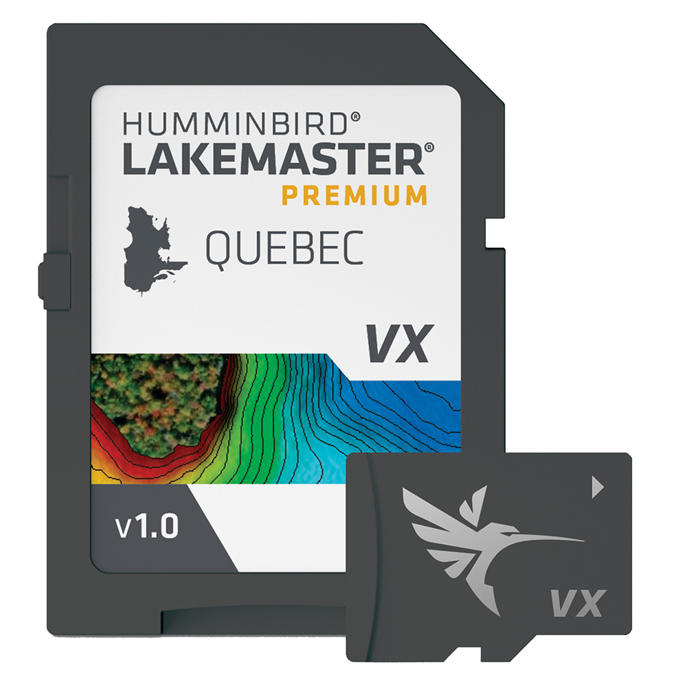
Humminbird LakeMaster VX Premium - Quebec
Humminbird LakeMaster VX Premium - Quebec
Online
$199.99for Each
Retail $199.99
Mfr PN: 602021-1
Stock: 9
|
LakeMaster® VX Premium - Quebec An upgraded premium mapping solution in Humminbird LakeMaster VX to help anglers understand what is under the water’s surface better than ever before. For decades, Humminbird LakeMaster® has led the charge with the most accurate and advanced mapping available for anglers. Now, LakeMaster is taking it to an entirely new level with the introduction of Humminbird LakeMaster maps with VX Technology. The LakeMaster name has been praised among anglers for having the highest quality mapping for fishing, often collected by a team of GIS analyst cartographers. Now with VX Technology, LakeMaster maps are packed with more information than ever before, including five new customizable color palettes, exceptional map performance, and a powerful combination of features. The LakeMaster lineup maintains the same regions as the current lineup, but with two options per region: LakeMaster and LakeMaster Premium. Both products now include SmartStrike technology as a feature, allowing anglers to enter search parameters like season, time of day, temperature, and targeted fish species to create a custom chart that highlights areas of the map where fish are most likely to be biting. LakeMaster and LakeMaster Premium also include customizable Chart Presets, Depth Highlight, Shallow Water Highlight, Water Level Offset, and One-Boat Network capability. And for an added advantage, LakeMaster Premium includes two additional features: 2D Shaded Relief and Aerial Imagery. LakeMaster has been the go-to road map for anglers, and compared to the competition, what you see on the map is actually on the lake bottom. With LakeMaster with VX Technology, Humminbird LakeMaster solidifies its place as the most accurate and detailed fishing map on the market. Features:
|
Online
$199.99for Each
Retail $199.99
Mfr PN: 602021-1
Stock: 9
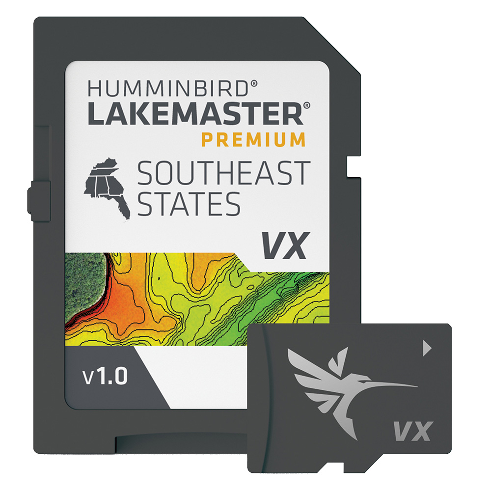
Humminbird LakeMaster VX Premium - Southeast
Humminbird LakeMaster VX Premium - Southeast
Online
$199.99for Each
Retail $199.99
Mfr PN: 602008-1
Stock: 111
|
LakeMaster® VX Premium - Southeast An upgraded premium mapping solution in Humminbird LakeMaster VX to help anglers understand what is under the water’s surface better than ever before. For decades, Humminbird LakeMaster® has led the charge with the most accurate and advanced mapping available for anglers. Now, LakeMaster is taking it to an entirely new level with the introduction of Humminbird LakeMaster maps with VX Technology. The LakeMaster name has been praised among anglers for having the highest quality mapping for fishing, often collected by a team of GIS analyst cartographers. Now with VX Technology, LakeMaster maps are packed with more information than ever before, including five new customizable color palettes, exceptional map performance, and a powerful combination of features. The LakeMaster lineup maintains the same regions as the current lineup, but with two options per region: LakeMaster and LakeMaster Premium. Both products now include SmartStrike technology as a feature, allowing anglers to enter search parameters like season, time of day, temperature, and targeted fish species to create a custom chart that highlights areas of the map where fish are most likely to be biting. LakeMaster and LakeMaster Premium also include customizable Chart Presets, Depth Highlight, Shallow Water Highlight, Water Level Offset, and One-Boat Network capability. And for an added advantage, LakeMaster Premium includes two additional features: 2D Shaded Relief and Aerial Imagery. LakeMaster has been the go-to road map for anglers, and compared to the competition, what you see on the map is actually on the lake bottom. With LakeMaster with VX Technology, Humminbird LakeMaster solidifies its place as the most accurate and detailed fishing map on the market. Features:
|
Online
$199.99for Each
Retail $199.99
Mfr PN: 602008-1
Stock: 111
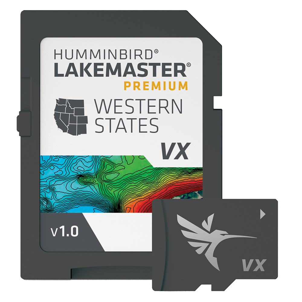
Humminbird LakeMaster VX Premium - Western States
Humminbird LakeMaster VX Premium - Western States
Online
$199.99for Each
Retail $199.99
Mfr PN: 602009-1
Stock: 9
|
LakeMaster® VX Premium - Western States An upgraded premium mapping solution in Humminbird LakeMaster VX to help anglers understand what is under the water’s surface better than ever before. For decades, Humminbird LakeMaster® has led the charge with the most accurate and advanced mapping available for anglers. Now, LakeMaster is taking it to an entirely new level with the introduction of Humminbird LakeMaster maps with VX Technology. The LakeMaster name has been praised among anglers for having the highest quality mapping for fishing, often collected by a team of GIS analyst cartographers. Now with VX Technology, LakeMaster maps are packed with more information than ever before, including five new customizable color palettes, exceptional map performance, and a powerful combination of features. The LakeMaster lineup maintains the same regions as the current lineup, but with two options per region: LakeMaster and LakeMaster Premium. Both products now include SmartStrike technology as a feature, allowing anglers to enter search parameters like season, time of day, temperature, and targeted fish species to create a custom chart that highlights areas of the map where fish are most likely to be biting. LakeMaster and LakeMaster Premium also include customizable Chart Presets, Depth Highlight, Shallow Water Highlight, Water Level Offset, and One-Boat Network capability. And for an added advantage, LakeMaster Premium includes two additional features: 2D Shaded Relief and Aerial Imagery. LakeMaster has been the go-to road map for anglers, and compared to the competition, what you see on the map is actually on the lake bottom. With LakeMaster with VX Technology, Humminbird LakeMaster solidifies its place as the most accurate and detailed fishing map on the market. Features:
|
Online
$199.99for Each
Retail $199.99
Mfr PN: 602009-1
Stock: 9
Humminbird LakeMaster VX Premium - Wisconsin
Humminbird LakeMaster VX Premium - Wisconsin
Online
$199.99for Each
Retail $199.99
Mfr PN: 602010-1
Stock: 2
|
LakeMaster® VX Premium - Wisconsin An upgraded premium mapping solution in Humminbird LakeMaster VX to help anglers understand what is under the water’s surface better than ever before. For decades, Humminbird LakeMaster® has led the charge with the most accurate and advanced mapping available for anglers. Now, LakeMaster is taking it to an entirely new level with the introduction of Humminbird LakeMaster maps with VX Technology. The LakeMaster name has been praised among anglers for having the highest quality mapping for fishing, often collected by a team of GIS analyst cartographers. Now with VX Technology, LakeMaster maps are packed with more information than ever before, including five new customizable color palettes, exceptional map performance, and a powerful combination of features. The LakeMaster lineup maintains the same regions as the current lineup, but with two options per region: LakeMaster and LakeMaster Premium. Both products now include SmartStrike technology as a feature, allowing anglers to enter search parameters like season, time of day, temperature, and targeted fish species to create a custom chart that highlights areas of the map where fish are most likely to be biting. LakeMaster and LakeMaster Premium also include customizable Chart Presets, Depth Highlight, Shallow Water Highlight, Water Level Offset, and One-Boat Network capability. And for an added advantage, LakeMaster Premium includes two additional features: 2D Shaded Relief and Aerial Imagery. LakeMaster has been the go-to road map for anglers, and compared to the competition, what you see on the map is actually on the lake bottom. With LakeMaster with VX Technology, Humminbird LakeMaster solidifies its place as the most accurate and detailed fishing map on the market. Features:
|
Online
$199.99for Each
Retail $199.99
Mfr PN: 602010-1
Stock: 2
|
|
|
|
Copyright © 2009-2024 A part of the Intelastores, Inc. Store Network Site Designed and Maintained by Inline Internet Systems, Inc. |